

A PCH road trip is a drive along California’s Pacific coast, mostly on Highway 1, that strings together ocean cliffs, beaches, state parks, and small coastal towns between San Francisco and Southern California. Most travelers link Monterey, Big Sur, San Luis Obispo, Santa Barbara and Los Angeles, and they plan anywhere from three days to two weeks for it. The short version of what you need to know before you go: the scenery is the point, the driving is slower than your map app claims, and road conditions on the Big Sur stretch can change fast, so check them before every driving day.
If that sounds like your kind of trip, good. This guide walks through the route in the order you’d actually drive it, with honest advice on timing, money, sleeping arrangements, and the mistakes that trip people up. If you’re still deciding between road trips in general, our road trip section has more routes to compare.
Quick answer: A PCH road trip is a scenic drive along California’s Pacific coast, mostly on Highway 1, linking beaches, cliffs, state parks and coastal towns between San Francisco and Southern California. Most travelers stitch together Monterey, Big Sur, San Luis Obispo, Santa Barbara and Los Angeles, and give it anywhere from three days to two weeks.
What Is a PCH Road Trip?
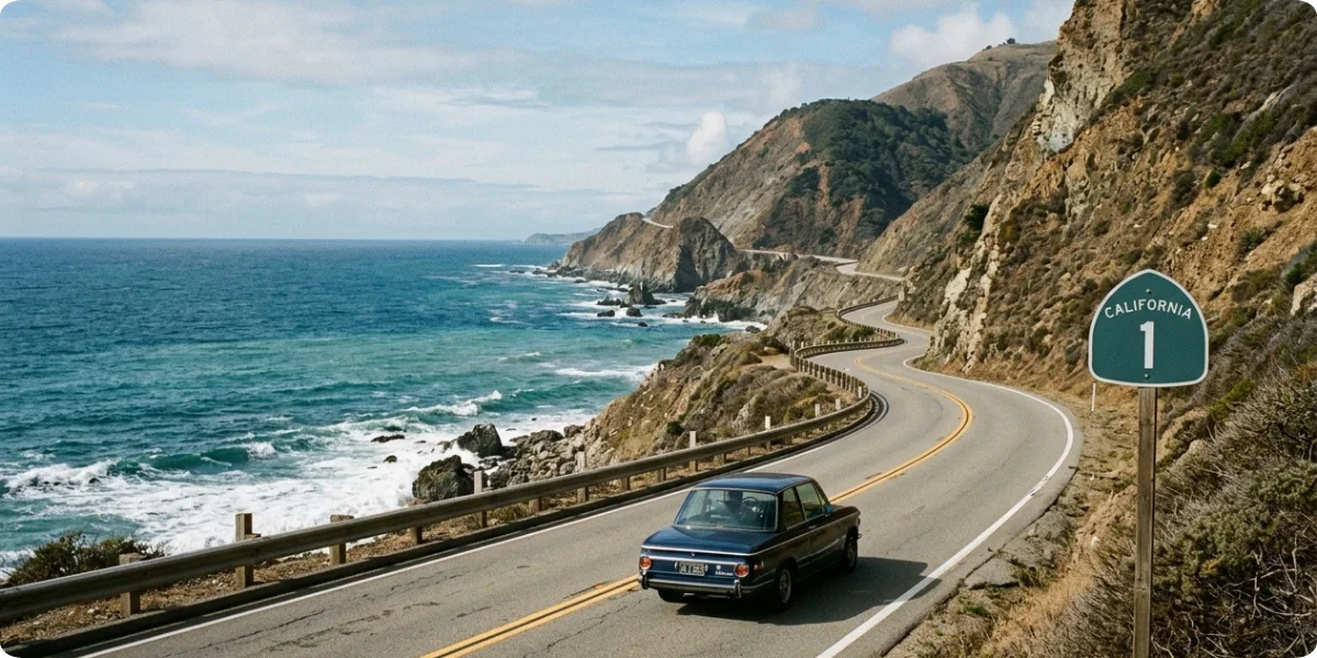
PCH stands for Pacific Coast Highway. Here’s what confuses almost everyone: there isn’t one road with that single name from top to bottom. California State Route 1 is the official highway, and according to the route’s Wikipedia entry, different sections of it carry names such as Pacific Coast Highway, Cabrillo Highway, Shoreline Highway, and Coast Highway. The route is about 656 miles long, making it California’s longest state route, and it runs from Interstate 5 at Dana Point in the south to US 101 near Leggett in the north.
So is PCH the same as Highway 1? Mostly, yes. Highway 1 is the route number on the sign, and PCH is the name locals and travelers use for the coastal drive, especially in Southern California. In Big Sur, you’ll also see it called the Big Sur Coast Highway, a stretch of roughly 71 miles that many people consider the heart of the whole experience. One detail worth knowing: Highway 1 isn’t continuous in the way you might expect. It merges with US 101 for a 54-mile stretch through Ventura and Santa Barbara counties, and it crosses the Golden Gate Bridge into San Francisco.
What makes this different from a standard California road trip? Speed, mostly. A typical highway drive is about getting somewhere. This one is about the pullouts, the fog banks rolling over a ridge, the bridge you didn’t plan to photograph, and the taco stand you found by accident. The road is two lanes in many places, cut into cliffs, with limited gas and patchy cell service in the middle. You can technically drive a long coastal stretch in a day. You just shouldn’t.
How long does the full route take? That depends on what you count as “full.” Driving every mile of Highway 1 from Leggett to Dana Point is a one- to two-week project. The version most people mean, San Francisco or Monterey down to Los Angeles, fits comfortably into 5 to 7 days and can be squeezed into 3 if you accept that you’ll be seeing the coast mostly through the windshield.
Where Does the PCH Road Trip Start and End?
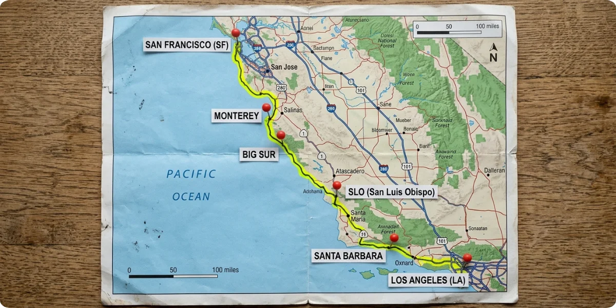
There’s no official starting line, which is both the freedom and the headache. Pick based on where you’re flying in, how much time you have, and what you want to see most.
1. Northern Starting Points
San Francisco is the classic launch point. You get big-city energy, easy flights and rental cars, and the drive out over the Golden Gate Bridge sets the mood nicely. From here you can follow the coast through Half Moon Bay and Santa Cruz toward Monterey, or take the faster inland roads if you’re short on time.
Monterey works better if you only have a few days. Starting here puts you within a short drive of Carmel and the Big Sur coast, so you spend your limited hours on the dramatic part rather than the approach. The trade-off is that you’ll need to get yourself to Monterey first, which usually means a drive or shuttle from San Francisco or San Jose.
Other starting points exist, too. Some travelers begin farther north in Marin County or Mendocino County for a wilder, quieter version, and Santa Cruz makes a relaxed first night if you want to ease in.
2. Southern Starting Points
Los Angeles is the easy choice if you’re flying into LAX. You can start in Santa Monica or Malibu, head up the coast and finish in San Francisco. Orange County is a good alternative if you want beach towns like Laguna Beach and Newport Beach at the front of your trip, and since Highway 1 officially ends at Dana Point, it’s a natural bookend. San Diego isn’t on Highway 1 itself, but many travelers add it by continuing south on Interstate 5 from Dana Point, which turns the trip into a full California coast run.
3. Best Direction to Drive the PCH
Both directions work, so don’t let anyone tell you there’s only one right answer. That said, there are real differences.
- North to south (San Francisco toward Los Angeles) puts the ocean on your right. Because most pullouts and viewpoints sit on the ocean side of the road, you simply turn right into them, with no crossing of oncoming traffic. It also puts you in the lane nearest the water through Big Sur, which is the best seat in the house. Most guides lean this way for first-timers, and it’s what we’d suggest.
- South to north (Los Angeles toward San Francisco) keeps the ocean on your left, so pulling into viewpoints means turning across the opposite lane. That’s fine on a quiet morning and slightly nerve-racking on a busy weekend. The upside is that you finish in San Francisco, and some travelers like ending in the Bay Area.
A note for visitors from abroad: traffic in the US drives on the right, and on this road the cliff edge will often be on your side. Take corners wide enough, stay in your lane, and let faster local traffic pass when you can.
How Long Do You Need for a PCH Road Trip?
The honest answer is “longer than you think.” The distances look short on a map, but the road is slow, the stops are tempting, and the light changes everything. Use our trip duration calculator if you want to sanity-check your dates against your plans. Here’s how the different lengths tend to feel.
| Trip Length | Best For | Suggested Experience |
|---|---|---|
| 2–3 days | A short coastal escape | Monterey, Carmel, and a Big Sur day trip, or San Francisco to San Luis Obispo with a lot of driving |
| 4–5 days | First-time visitors | Main coastline from Monterey to Santa Barbara or Los Angeles, with one or two big stops per day |
| 7 days | A comfortable road trip | Scenic stops, small towns, a hike or two and at least one slow morning |
| 10–14 days | Slow travel | Deeper exploration, extra nights in Big Sur and Santa Barbara, beach time and side trips |
Best PCH Road Trip Length for First-Time Visitors
Five to seven days is the sweet spot. Five days lets you hit the headline sights without feeling chased. Seven gives you room for the things that make a road trip memorable the unplanned detour, the long lunch, the sunset you refuse to leave. If you only have three days, go for it, but pick a shorter section rather than trying to cover everything.
Best PCH Road Trip Route
Think of the drive as five legs. Each has its own character, and knowing what’s coming helps you decide where to slow down. If you like to check mileage before you commit, our distance calculator is handy for building the legs.
1. San Francisco to Monterey
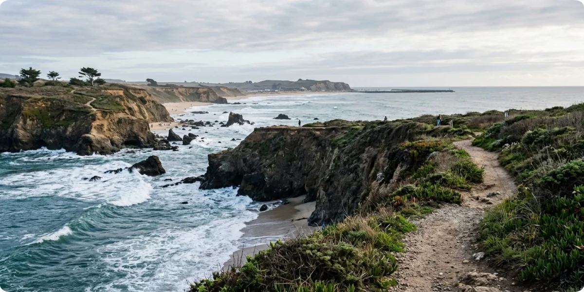
This is the warm-up. The coast south of San Francisco has windswept headlands, farm stands and surf towns, and the road passes through places like Half Moon Bay and Santa Cruz before reaching Monterey Bay. Expect a mix of coastal two-lane and faster inland road, depending on which way you go. In Monterey, the big draws are Cannery Row, the waterfront and the famous aquarium, and the town makes an easy first or second night.
2. Monterey to Big Sur
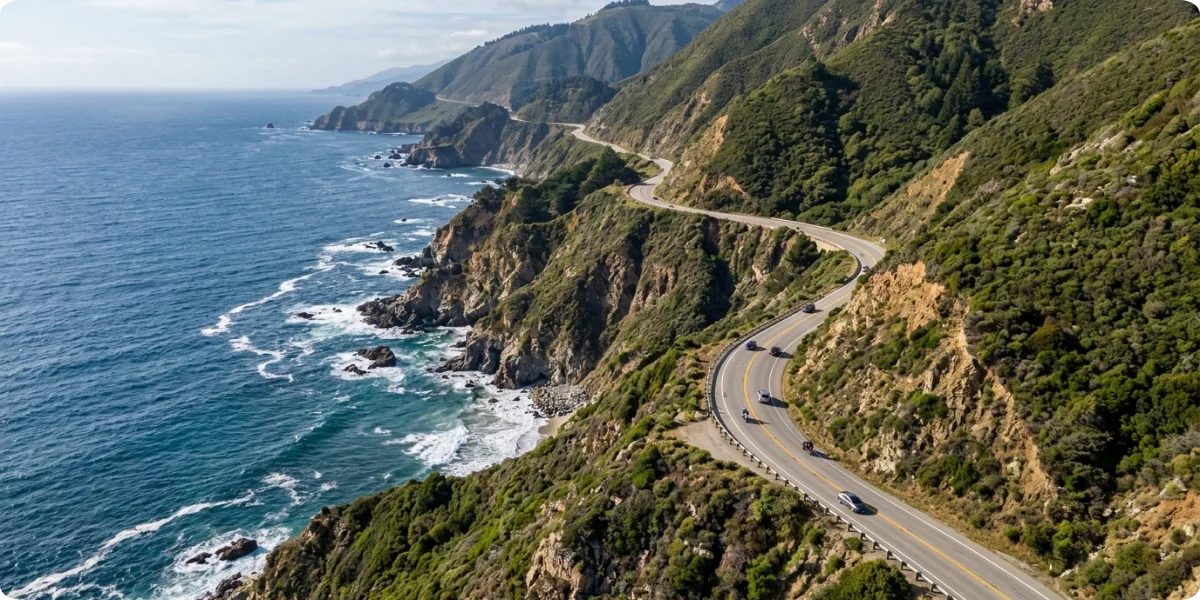
This is where the trip earns its reputation. Past Carmel, Highway 1 starts to twist along steep cliffs above the Pacific. Bixby Creek Bridge is the first big moment, and you’ll find several viewpoints and state parks over the following miles. The Big Sur Coast Highway is narrow, slow and genuinely spectacular, and the main rule is not to rush it. Give this leg most of a day.
3. Big Sur to San Luis Obispo
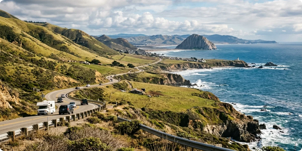
South of Big Sur, the coast softens a little, but not much. You’ll pass Hearst Castle near San Simeon, the elephant seal viewing area at Piedras Blancas, cozy Cambria and the harbor town of Morro Bay with its giant volcanic rock. The road is less cliff-hanging here and more rolling, with stretches of open ranch land running right down to the water. San Luis Obispo itself is a friendly college town and a good place to rest.
4. San Luis Obispo to Santa Barbara
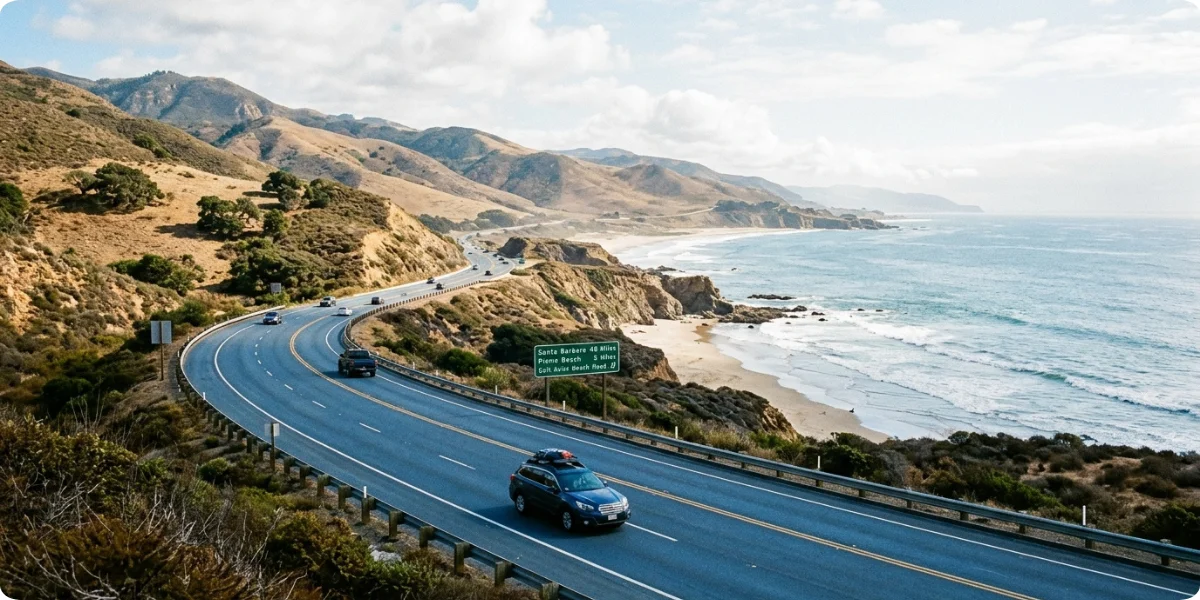
This leg brings beaches and small coastal towns, including Pismo Beach and Avila Beach, then you swing south toward Santa Barbara. Along the way, wine country is within easy reach if you’re willing to detour inland, particularly toward the Santa Ynez Valley. The route spends part of this section on US 101 rather than Highway 1, which is perfectly normal and still scenic in places.
5. Santa Barbara to Los Angeles
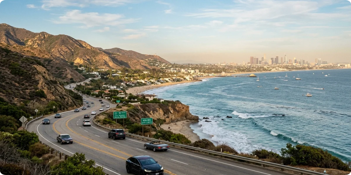
The final stretch is more urban but no less coastal. After Santa Barbara, you’ll head south, and around Oxnard the road returns to Highway 1 and the Pacific Coast Highway you probably imagined from the movies. Malibu is the star here, with long beaches and ocean views, followed by Santa Monica and the rest of Los Angeles. If you’re continuing, Orange County’s beach towns are next.
Best Stops on a PCH Road Trip
Instead of a random attractions list, here are the stops in the order you’ll reach them heading south. For each, we’ve tucked in why it’s worth stopping, how long you really need and what to do if it’s too busy.
1. Monterey
Monterey is worth a stop for its waterfront, its history and the marine life in the bay. Allow half a day to a full day, longer if you’ll visit the aquarium properly. The best experience is simple: wander the waterfront early, before the crowds, then eat seafood somewhere with a view. If it’s packed, Pacific Grove just next door is quieter and has lovely coastal walking paths.
2. Carmel-by-the-Sea
Carmel feels like a storybook village with cottages, galleries and a white-sand beach at the foot of the main street. You can see the highlights in two to three hours, or stretch it to a half day with a beach walk. Nearby, Point Lobos State Natural Reserve is a stunning alternative if you’d rather spend your time outdoors, though it’s popular, so go early. The 17-Mile Drive between Carmel and Pebble Beach is another option, and it charges an entry fee.
3. Big Sur
Big Sur isn’t one stop, it’s a whole landscape, and you’ll want at least a full day, ideally an overnight. The best experience is combining a short hike or beach walk with slow driving and several viewpoints. McWay Falls at Julia Pfeiffer Burns State Park, where a waterfall drops onto the beach, is a favorite. If you can’t get a room, Carmel Valley or Cambria make workable bases. For hike ideas along the coast, browse our hiking guides.
4. Bixby Creek Bridge
Bixby Creek Bridge is one of the most photographed bridges in California for good reason. According to Wikipedia’s entry on the bridge, it’s a reinforced concrete open-spandrel arch about 714 feet long, and it opened in November 1932. Heights quoted online range from roughly 260 to 280 feet above the creek, depending on the source. You only need 15 to 30 minutes here. The best experience is arriving early or late in the day to avoid the crowds and the harshest light. If the main pullout is jammed, other turnouts nearby offer different angles, so be patient and park legally.
5. Hearst Castle
Hearst Castle, the hilltop estate of newspaper magnate William Randolph Hearst, sits on a ridge above San Simeon and is run by California State Parks. Plan two to three hours for a guided tour. Tour tickets can be bought online up to 60 days in advance, and in busy periods it pays to book early. If the castle isn’t your thing, the Piedras Blancas elephant seal viewing area a few miles north is free and open daily, according to Friends of the Elephant Seal, and it takes about 30 to 60 minutes. Winter is the busiest and most dramatic season for the seals.
6. Morro Bay
Morro Bay is a laid-back fishing town dominated by Morro Rock, a huge volcanic plug standing at the harbor mouth. Give it two to three hours. The best experience is a harborfront stroll, or a kayak paddle if conditions are calm, where you might spot sea otters. If you want something quieter, nearby Cayucos has a small-town beach feel and a classic pier.
7. Pismo Beach
Pismo is classic California beach culture: a pier, clam chowder and a long stretch of sand. Plan one to two hours for a stop, or more for beach time. In the cooler months, you may find the Monarch Butterfly Grove worth a visit, since butterflies typically gather there between November and February. If it’s crowded, Avila Beach just up the road has a calmer, more sheltered feel.
8. Santa Barbara
Santa Barbara is often a trip highlight, with Spanish-style architecture, a palm-lined waterfront and a historic mission. Allow half a day to a full day, and an overnight is even better. The best experience is a stroll along Stearns Wharf, a wander through the downtown, then a sunset by the water. For something less busy, Carpinteria just south offers a mellow beach town vibe, and our beach guides can help you compare coastal spots.
9. Malibu
Malibu is a long ribbon of coastline rather than a single place, and the beaches are the draw. Plan two to four hours at minimum. Great experiences include a beach stroll at El Matador State Beach, a walk at Point Dume or simply driving the coast with the windows down. If Malibu feels too busy or expensive, Santa Monica and the South Bay beaches offer plenty of sand with easier parking and more food options.
Best Scenic Views Along the PCH
The coast gives you a different kind of scenery every hour, so it helps to know what to look for and roughly where to find it.
Ocean overlooks are everywhere on the Monterey and Big Sur stretches, and they’re typically signed turnouts on the ocean side of the road. Cliffside viewpoints cluster around Big Sur, where the highway sits hundreds of feet above the surf. Bridges are a signature feature, with Bixby Creek Bridge the best known but not the only one. Beaches range from white-sand Carmel to the wide flats of Pismo and the long sweeps near Malibu. Forested sections appear in the redwood canyons of Big Sur, where the road dips inland for a while and the air smells of trees rather than salt. And sunset viewpoints are plentiful on the western-facing coast, especially from Big Sur, Morro Bay and Santa Barbara’s waterfront.
Most Photogenic PCH Viewpoints
Rather than chasing a list of trendy spots, think in terms of timing and practicalities. Bixby Creek Bridge looks great in soft morning or late-afternoon light, and fog can add drama, but visibility swings, so build in flexibility. McWay Falls is a short walk from a viewing area, which means you don’t need a big hike for a great photo. Point Lobos and Garrapata offer rugged shoreline close to the road. Whatever you photograph, park only in marked areas and never stop in the travel lane. The photo isn’t worth a collision or a ticket.
Best Time for a PCH Road Trip
The coast has its own weather system, and what’s sunny in Los Angeles can be foggy in Monterey. Our seasonal travel guides cover month-by-month ideas if you’re juggling other plans.
1. PCH in Spring
Spring brings green hillsides and, in good years, wildflowers along the coast. Temperatures are mild, and crowds are lighter than summer except around school holidays. The trade-off is that lingering storm effects can still affect roads, so keep an eye on conditions.
2. PCH in Summer
Summer is peak season. Visitor numbers are highest, parking is harder and lodging is expensive. Coastal fog is common, especially in the mornings, and it can hide the very views you came for. Inland temperatures may be hot while the coast stays cool, so layers matter more than you’d think.
3. PCH in Fall
Many travelers consider fall the best season. Crowds thin after the summer rush, the weather is often clearer, and temperatures tend to be comfortable. Roads are usually in better condition than in winter, although wildfire activity can occasionally affect closures, so stay flexible.
4. PCH in Winter
Winter means rain, rougher seas and a higher chance of slides or debris on the road, particularly through Big Sur. Daylight is short, so you’ll cover fewer miles. The upside is the elephant seal colony, which swells in winter, and a moody, uncrowded coast. If you travel then, build slack into your itinerary.
5. Best Month for a PCH Road Trip
If we had to choose one, we’d pick September or October for the best mix of clearer weather, fewer crowds and dependable driving, with April to May as a strong runner-up. That said, conditions vary by section. Southern California can be warm while Big Sur is foggy, and a single storm can change the picture overnight, so treat any month as a starting point rather than a guarantee.
How Much Does a PCH Road Trip Cost?
Costs vary wildly depending on season, car, hotel style and how often you eat out, so treat the numbers below as rough planning figures rather than quotes. They assume two travelers sharing a car and a room, per day, not counting flights.
| Cost Item | Budget | Mid-Range | Luxury |
|---|---|---|---|
| Rental car | $55–$80 | $80–$110 | $120–$200 |
| Fuel | $30–$45 | $35–$55 | $40–$60 |
| Hotels | $120–$180 | $200–$320 | $450–$900+ |
| Food | $50–$70 | $90–$140 | $180–$300 |
| Parking and attractions | $10–$25 | $30–$60 | $60–$120 |
| Insurance and emergency buffer | $10–$20 | $20–$30 | $30–$50 |
| Estimated daily total | $275–$420 | $455–$715 | $880–$1,600+ |
1. Budget PCH Road Trip
A budget trip leans on motels, inland towns just off the coast, picnic lunches and free beaches. Camping can cut costs sharply if you reserve early, and our camping guides are a good place to start. The biggest savings come from staying outside the priciest coastal towns and eating one big meal a day instead of three.
2. Mid-Range PCH Road Trip
Mid-range travelers can mix comfortable hotels with a few special stays, sit-down dinners and paid attractions like Hearst Castle. This is where most people land, and it allows for a splurge or two, such as a night in Big Sur or Santa Barbara, without breaking the budget.
3. Luxury PCH Road Trip
Luxury means ocean-view rooms, high-end dining, and perhaps a convertible or SUV. Prices in Big Sur, Carmel, and Malibu climb quickly, and booking far ahead matters if you want a particular room.
Want to run your own numbers? Try our trip cost calculator and adjust for your travel style, or check money and budget tips before you book.
Where to Stay on a PCH Road Trip
Rather than scatter hotel names, it’s more useful to think by stretch of road. Across the whole route, three habits save money and stress: book ahead for summer and holidays, ask about parking before you reserve (it can be pricey or limited in coastal towns), and consider staying a few miles inland or in a neighboring town where rates drop. Ocean-view rooms are lovely, but they often cost far more than a room a short drive from the water, and you’ll spend most of your day out anyway. Browse our hotel guides for more ideas.
1. Where to Stay in Monterey
Cannery Row and the waterfront put you close to the action but cost more. Pacific Grove and areas a little inland tend to be calmer and better value. Book early in summer, since Monterey fills up on weekends.
2. Where to Stay Near Big Sur
Big Sur has limited lodging, and it sells out well in advance. If you can’t find a room, Carmel Valley, Carmel or Cambria are practical alternatives, though you’ll add driving time. Remember that dining and fuel options are sparse in the middle of Big Sur, so plan accordingly.
3. Where to Stay in San Luis Obispo
San Luis Obispo’s downtown is walkable and has a wide range of hotels. Morro Bay, Pismo Beach and Avila Beach are good coastal options nearby, with Pismo usually busier and Morro Bay a bit more relaxed.
4. Where to Stay in Santa Barbara
The waterfront and downtown are convenient but expensive. For better rates, look at Goleta or Carpinteria, both within easy reach of the main sights.
5. Where to Stay Near Malibu
Malibu lodging is limited and pricey. Many travelers stay in Santa Monica or along the Ventura coast and drive in for the day, which keeps costs manageable and widens your food choices.
What to Pack for a PCH Road Trip
A smart packing list is short and practical. If it’s your first big drive, our first road trip essentials post covers the basics well.
1. Road Trip Essentials
Bring a reliable navigation setup and a phone charger, plus a power bank so you’re not stranded when the screen dies. Carry plenty of water and a few snacks, since services can be far apart, and pack a small first-aid kit for blisters, cuts and headaches.
2. Clothing
Coastal weather swings, so pack layers: a light jacket, a warm layer and something breathable for the sun. Comfortable shoes matter for viewpoints and short hikes. If you’re traveling in the wetter months, add rain protection too.
3. Car Essentials
Download offline maps before you lose service, and keep spare charging cables in the car. Add basic emergency supplies, such as a flashlight, a blanket and some extra water, in case you get stuck during a closure or slow-moving traffic.
Driving Tips for the PCH
The drive isn’t technically hard, but it rewards patience. Check road conditions before you leave each morning, using Caltrans’ Highway 1 road conditions page and local travel alerts like Monterey County’s travel alerts. Fill up when fuel is available, since stations are sparse and often pricey in remote areas. Don’t rely entirely on mobile service, because coverage in Big Sur is weak, and download maps before you enter those stretches.
Then there are the basics that matter on a winding road. Allow extra time for viewpoints, because nobody should be rushing past a view like this. Follow posted speed limits, which are low for a reason, and watch for cyclists and pedestrians around blind corners. Avoid stopping in unsafe roadside areas, and use real pullouts instead. If a line of cars builds up behind you, pull over and let them pass. And keep valuables out of the vehicle when you park at busy viewpoints, because break-ins can happen at popular stops.
PCH Road Trip Mistakes to Avoid
1. Trying to Drive the Entire Coast Too Quickly
The most common mistake is cramming too much into too few days. The road is slow and the stops are worth it. Pick a section you can enjoy rather than the whole thing at a sprint.
2. Booking Every Night in a Different Place
Packing and unpacking every night eats your energy. Aim for two nights in a few key bases, such as Monterey or Carmel, Cambria or San Luis Obispo and Santa Barbara, with shorter day drives in between.
3. Ignoring Road Closures
Highway 1 has a history of slides and fire-related closures. As the Santa Barbara Independent reported, a stubborn slide at Regent’s Slide kept part of Big Sur closed for a long stretch before reopening in January 2026. Closures can happen with little notice, so check conditions daily and keep a backup route in mind.
4. Underestimating Coastal Weather
Fog, wind and sudden temperature drops catch visitors off guard, particularly in summer. Dress in layers and don’t assume that sunshine inland means clear skies on the coast.
5. Skipping Small Coastal Towns
Some of the best moments come from places you didn’t plan to stop: a bakery in Cambria, a harbor in Morro Bay, a quiet beach in Carpinteria. Leave room in your schedule for them.
6. Planning Only Around Major Attractions
If every hour is scheduled around a big-name stop, you’ll miss the point of a road trip. Aim for one or two anchors a day and leave the rest open.
7. Driving After Dark on Unfamiliar Coastal Roads
Cliffside roads without streetlights, wildlife crossing the road and fog make night driving stressful. Try to finish your driving before sunset, especially in Big Sur and in winter.
Is the PCH Road Trip Safe?
It’s a well-traveled route, and most trips go smoothly, but it deserves respect. A realistic view beats a simple yes or no.
- General driving: Expect narrow lanes, tight curves and slow-moving traffic.
- Cliffside roads have steep drop-offs, so stay alert and avoid distracted driving.
- Weather-related risks, especially rain, can lead to slick roads and debris, while fog can cut visibility to a few car lengths.
- Landslides and rockfall have closed parts of Highway 1 for long periods, which is why checking conditions matters.
- Wildlife can appear at dawn and dusk, so slow down.
- Parking safety matters too, since popular viewpoints can attract thieves, so don’t leave valuables visible.
Finally, think about road closures and emergency preparation. Carry water, a charged phone and a paper or offline map, tell someone your rough route and be ready to change plans if conditions shift. With a little preparation, most visitors find it a safe and unforgettable drive.
PCH Road Trip Itinerary
1. 3-Day PCH Itinerary
San Francisco → Monterey → Big Sur → San Luis Obispo. This is a tight version, and it ends in San Luis Obispo rather than Los Angeles, which is the realistic way to do three days.
- Day 1: San Francisco to Monterey. Leave early, take the coastal route through Half Moon Bay and Santa Cruz if you have time, and finish with Cannery Row and a seafood dinner.
- Day 2: Monterey to Cambria. Spend the morning in Carmel, then take the slow drive through Big Sur with stops at Bixby Creek Bridge and a viewpoint or two. Aim to reach Cambria or San Simeon by evening.
- Day 3: Cambria to San Luis Obispo. Visit the elephant seals, then Morro Bay, and finish in San Luis Obispo.
2. 5-Day PCH Itinerary
This version adds Carmel, the Hearst Castle area and Santa Barbara.
- Day 1: San Francisco to Monterey, with a stop in Santa Cruz.
- Day 2: Explore Carmel and Point Lobos, then begin the Big Sur drive.
- Day 3: Big Sur to the Hearst Castle area, including the elephant seals, with an overnight in Cambria.
- Day 4: Morro Bay and Pismo Beach, then continue to Santa Barbara.
- Day 5: Santa Barbara to Malibu and Los Angeles.
3. 7-Day PCH Itinerary
With a week, you can slow down and add a few more coastal stops.
| Night | Base | What to Do |
|---|---|---|
| 1 | Santa Cruz or Monterey | Half Moon Bay, boardwalk or Cannery Row |
| 2 | Monterey or Carmel | Point Lobos, Carmel village, an unhurried morning |
| 3 | Big Sur or Carmel Valley | Bixby Creek Bridge, McWay Falls, a short hike |
| 4 | Cambria | Hearst Castle, elephant seals, Moonstone Beach |
| 5 | San Luis Obispo or Pismo | Morro Bay, Pismo Beach, Avila Beach |
| 6 | Santa Barbara | Stearns Wharf, the mission, wine-country detour if time allows |
| 7 | Malibu area or Los Angeles | Beaches and viewpoints, then Santa Monica |
4. 10-Day PCH Itinerary
This is the relaxed version, with more time for beaches, hikes, towns and viewpoints.
| Nights | Base | What to Do |
|---|---|---|
| 1 | San Francisco | Golden Gate Bridge, a slow start |
| 1 | Santa Cruz | Coastal stops, beach time |
| 2 | Monterey and Carmel | Aquarium, Point Lobos, the 17-Mile Drive |
| 2 | Big Sur | Bixby Creek Bridge, McWay Falls, trails and sunsets |
| 1 | Cambria | Hearst Castle, elephant seals |
| 1 | San Luis Obispo or Pismo | Morro Bay, Pismo Beach |
| 1 | Santa Barbara | Waterfront, mission, optional wine country |
| 1 | Malibu or Los Angeles | Beaches and coast |
Add a night in Orange County or Dana Point if you’d like to finish at the southern end of Highway 1. For more ways to plan your days, see our travel planning guides.
PCH Road Trip vs. Other California Road Trips
If you’re not sure the PCH is your best fit, this comparison helps.
| Road Trip | Best For |
|---|---|
| PCH (Highway 1) | Ocean scenery, beaches and coastal towns |
| Highway 101 | Faster coastal travel with fewer slow curves |
| Yosemite road trip | Mountains, granite cliffs and waterfalls |
| California desert road trip | Desert landscapes, big skies and national parks |
| Northern California coast | Rugged coastline, redwoods and fewer crowds |
Highway 101 is the sensible pick when you need to cover distance, and it runs along the coast in places. If you’d like to keep going north after California, our Highway 101 Oregon Coast guide picks up the story with another stunning coastal drive.
Frequently Asked Questions About a PCH Road Trip
How many days do you need for a PCH road trip?
Most travelers need five to seven days to enjoy the main stretch from Monterey to Los Angeles without rushing. Three days works for a shorter section, while ten to fourteen days suits slower exploring, extra nights in Big Sur and time for side trips and beaches.
What is the best month for a PCH road trip?
September and October are often best, with clearer skies, fewer crowds and generally dependable driving. April and May are a strong second choice. Conditions vary by section, so check the forecast and road conditions for the stretch you plan to drive.
Is PCH the same as Highway 1?
Largely, yes. Highway 1 is the official route number, and Pacific Coast Highway is one of several names given to sections of it, along with Cabrillo Highway and Coast Highway. In Big Sur it’s also called the Big Sur Coast Highway.
Is PCH difficult to drive?
It isn’t technically difficult, but it demands attention. Expect narrow lanes, tight curves, cliff edges and slow traffic, particularly in Big Sur. Drive at a relaxed pace, use pullouts to let others pass and avoid driving after dark if you’re unfamiliar with the road.
Can you drive the PCH in 3 days?
Yes, but you’ll need to choose a section. A realistic plan is San Francisco to San Luis Obispo with stops in Monterey and Big Sur. Trying to reach Los Angeles in three days means long driving days and little time at the viewpoints.
What are the best stops on the PCH?
Popular highlights include Monterey, Carmel-by-the-Sea, Big Sur, Bixby Creek Bridge, Hearst Castle, the Piedras Blancas elephant seals, Morro Bay, Pismo Beach, Santa Barbara and Malibu. Your best stops depend on your interests, so pick a few anchors and leave room for surprises.
Is PCH better northbound or southbound?
Many guides favor southbound, from San Francisco toward Los Angeles, because the ocean is on your right and viewpoint pullouts are easier to reach. Northbound is still a great drive, and finishing in San Francisco appeals to some travelers.
How much does a PCH road trip cost?
For two travelers, expect roughly $275 to $420 per day on a budget, about $455 to $715 for mid-range travel and $880 or more for luxury, excluding flights. Prices swing with season and location, so use our trip cost calculator to estimate your own.
Where should you stay on the PCH?
Base yourself in a few key spots: Monterey or Carmel, Cambria or San Luis Obispo, and Santa Barbara. Big Sur lodging is limited, so book early or stay in nearby towns. Staying a few miles inland can often save money.
Can you drive PCH in winter?
Yes, but be flexible. Winter brings rain, shorter days and a higher risk of slides and temporary closures, especially in Big Sur. Check road conditions daily, build slack into your schedule and carry emergency supplies.
Are there road closures along the PCH?
Yes, they happen, especially in Big Sur, where slides, storms, wildfires and maintenance work can close sections for hours, days or longer. Check Caltrans and local travel alerts before every driving day and have a backup route or overnight plan.
Final PCH Road Trip Planning Checklist
Before you hit the road, run through this quick list:
- Choose your direction (north to south is easiest for viewpoints)
- Select your trip length
- Check current road conditions on Caltrans and local alerts
- Reserve accommodation, especially in Big Sur and Santa Barbara
- Plan your fuel stops
- Download offline maps
- Identify your major viewpoints
- Leave room for spontaneous stops
- Check the weather before each driving day
The PCH rewards people who plan just enough and then let the coast do its thing. Pick your route, book the key nights, keep a flexible schedule, and enjoy one of the great drives in the world. For more ideas, browse our full road trip guides.
