
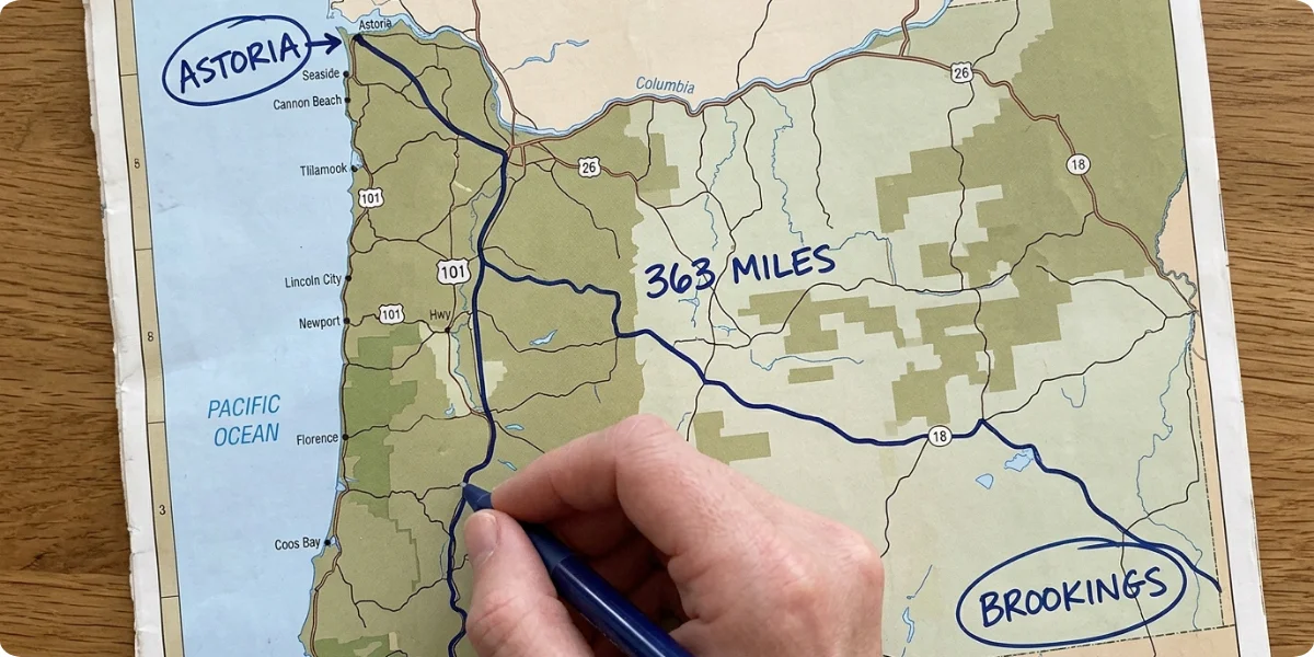
Quick answer: The Highway 101 Oregon Coast route is a 363-mile drive from Astoria in the north to Brookings in the south. Nonstop it takes about 10–12 hours, but most travelers need 3 to 7+ days to enjoy the beaches, sea stacks, lighthouses, forests and small towns along the way.
U.S. Highway 101 is the main coastal road through Oregon, and it is the simplest and most rewarding way to experience the state’s Pacific shoreline. The route is officially part of the Pacific Coast Scenic Byway, an All-American Road, and it covers roughly 363 miles between the Washington border near Astoria and the California border near Brookings. Because one highway links nearly every coastal community, you can build a trip of almost any length without complicated navigation: pick a direction, choose your bases, and let the ocean set the scenery.
What makes the Oregon Coast road trip different from many other scenic drives is how compact and varied it is. Within a single day’s drive you can move from the headlands and sea stacks of the north, through the lighthouses and tide pools of the central coast, to the Oregon Dunes and the remote, cliff-lined beaches of the south. Along the way you will pass beaches, sea stacks, lighthouses, viewpoints, temperate rainforest, wildlife-rich estuaries, small fishing towns and scenic state parks, many of them just a few minutes off the pavement. And because Oregon’s entire ocean shoreline is open to the public, you can walk down to the sand almost anywhere there is a legal access point.
This guide is built to help you plan the whole Highway 101 Oregon Coast drive, from the best stops and beaches to itineraries, seasons, safety, fuel and food. Where it helps, we point to official sources such as Travel Oregon and the Oregon Department of Transportation so you can confirm current conditions before you go.
What is Highway 101 on the Oregon Coast? U.S. Highway 101 is the main coastal road through Oregon, stretching roughly 363 miles from the Washington border near Astoria to the California border near Brookings. It runs between the Pacific Ocean and the Oregon Coast Range and is often the main street through the towns it passes.
Highway 101 Oregon Coast at a Glance
| Feature | Details |
|---|---|
| Route | U.S. Highway 101 (Oregon Coast Highway, Pacific Coast Scenic Byway) |
| Oregon Coast length | About 363 miles (584 km) |
| Northern end | Astoria (Columbia River, Washington border) |
| Southern end | Brookings (California border) |
| Route type | Coastal highway and designated scenic byway |
| Main experience | Beaches, viewpoints, towns, parks and wildlife |
| Nonstop driving time | Roughly 10–12 hours |
| Recommended trip | 3–7+ days |
| Best for | Road trips, photography, hiking and sightseeing |
The Pacific Coast Scenic Byway follows the Oregon shoreline for approximately 363 miles (584 km), and Travel Oregon lists a typical driving time of 10–12 hours. That figure assumes no stops, so treat it as a minimum rather than a plan. For route facts such as length and endpoints, the U.S. Route 101 in Oregon entry is a handy cross-check, and the Oregon Department of Transportation maintains the highway itself.
Where Does Highway 101 Start and End in Oregon?
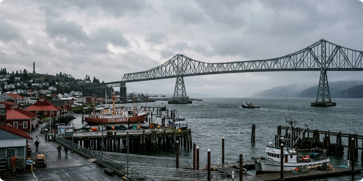
Highway 101 enters Oregon from Washington by crossing the Columbia River on the Astoria–Megler Bridge, which lands you in Astoria at the mouth of the river. That northern starting point is steeped in maritime and exploration history, and it is why Astoria is often described as the gateway to the Oregon Coast. From there, the highway heads south along the shoreline, and the byway officially ends at the Oregon–California border just south of Brookings.
The road hugs the coast for much of its length, but it does not follow the water everywhere. In several places it swings inland to cross rivers, climb over headlands, or pass through forest, which is why you sometimes lose sight of the ocean for several miles before it reappears at a new viewpoint. Large estuaries such as the Columbia, Tillamook Bay, Yaquina Bay, the Siuslaw, and Coos Bay also shape the route, with long bridges that are scenic in their own right.
There is an important difference between driving the highway continuously and exploring the coast. If you only follow the main road, you will see the highlights from the car window. The best parts of the Oregon Coast, however, are often a short detour, a trailhead or a beach walk away from the pavement: Cape Perpetua’s forest trails, the Three Capes Scenic Loop, the Bandon Beach Loop or the sea-carved coves of the Boardman corridor. Plan to leave the highway regularly.
Quick Route Answer
Astoria → Seaside → Cannon Beach → Tillamook → Lincoln City → Newport → Yachats → Florence → Coos Bay → Bandon → Port Orford → Gold Beach → Brookings
Highway 101 Oregon Coast Map and Route
The map should show Astoria, Cannon Beach, Tillamook, Lincoln City, Newport, Yachats, Florence, Coos Bay, Bandon, Port Orford, Gold Beach, and Brookings. To help with planning, the approximate driving distances between major stops are below. Treat them as estimates and confirm with a live map app, because detours, road work and construction can change them.
| Segment | Approx. distance | Typical drive time (no stops) | What you will pass |
|---|---|---|---|
| Astoria → Cannon Beach | 25–30 miles | About 45 minutes | Warrenton, Seaside, Fort Stevens area, Ecola State Park access |
| Cannon Beach → Tillamook | 45–50 miles | About 1 hour | Manzanita, Nehalem Bay, Rockaway Beach |
| Tillamook → Lincoln City | 50–55 miles | About 1 hour | Three Capes Loop junction, Pacific City area, Neskowin |
| Lincoln City → Newport | 25 miles | About 40 minutes | Depoe Bay, Cape Foulweather |
| Newport → Yachats | 25 miles | About 35 minutes | Seal Rock, Waldport |
| Yachats → Florence | 25–27 miles | About 35 minutes | Cape Perpetua, Sea Lion Caves, Heceta Head |
| Florence → Coos Bay | 50 miles | About 1 hour | Oregon Dunes National Recreation Area, Reedsport, Winchester Bay |
| Coos Bay → Bandon | 25 miles | About 35 minutes | Cape Arago Highway junction, Coquille |
| Bandon → Port Orford | 27 miles | About 35 minutes | Bandon Beach, Cape Blanco turnoff |
| Port Orford → Gold Beach | 28 miles | About 40 minutes | Humbug Mountain, Cape Sebastian |
| Gold Beach → Brookings | 28 miles | About 45 minutes | Thomas Creek Bridge, Samuel H. Boardman corridor |
For perspective, the northern two-thirds of the route, from Astoria to Florence, covers about 200 miles, which is one reason many travelers split the coast into two shorter trips rather than driving all 363 miles in one go.
Best Highway 101 Oregon Coast Stops
This is the heart of the guide. The 13 stops below are listed north to south and can be mixed into any itinerary.
1. Astoria
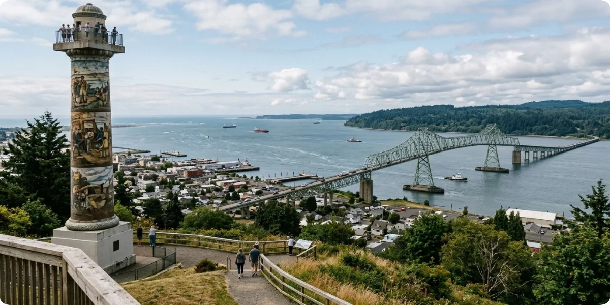
Astoria sits where the Columbia River meets the Pacific and is one of the oldest settlements west of the Rocky Mountains. The Astoria Column, a hilltop tower with painted murals and a panoramic view over the river mouth, is the best introduction to the area. Down by the water, the historic waterfront and the Columbia River Maritime Museum tell the story of the notoriously dangerous Columbia Bar, while nearby sites connected to Lewis and Clark history add context to the region’s exploration past. Allow at least half a day, and more if you want to include Fort Stevens State Park just west of town.
2. Seaside
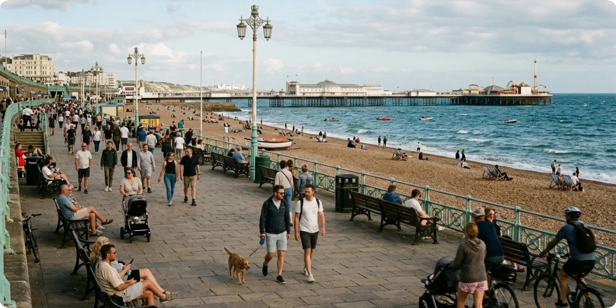
Seaside is the classic family beach town. A long, flat beachfront is bordered by a walkable promenade, and the town is packed with family-friendly attractions, arcades, ice cream shops, and casual restaurants. It is busy in summer and quieter and cheaper out of season. If you are traveling with children, this is one of the easiest stops on the north coast.
3. Cannon Beach
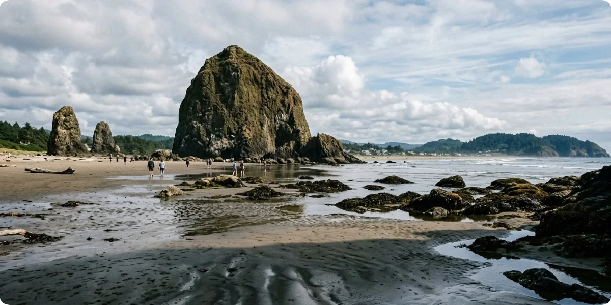
Cannon Beach is the most photographed stop on the north coast, and Haystack Rock, a sea stack rising roughly 235 feet from the sand, is the reason. Walk the beach at low tide to see tide pools and, in season, nesting seabirds. Just north, Ecola State Park offers forested viewpoints over the coastline and trails that have long been favorites for photography. The town itself is walkable, with galleries, bakeries, and small inns, so it makes a good overnight base for the north coast.
4. Tillamook
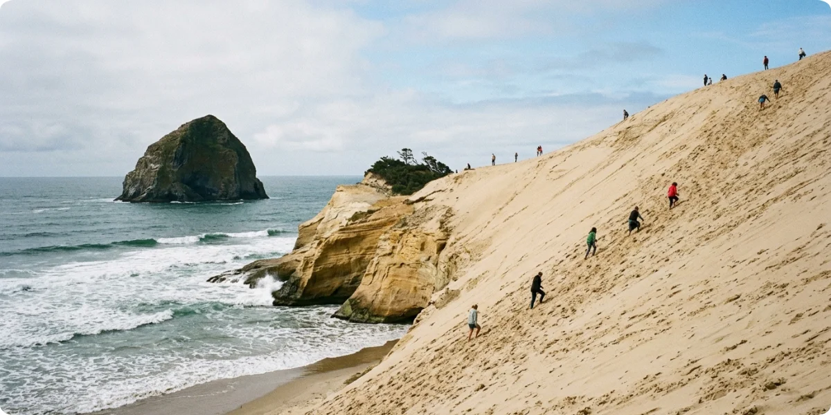
Tillamook is dairy country, and the Tillamook Creamery is the best-known visitor stop on this part of the coast. Beyond cheese, the area opens onto coastal viewpoints and is the entrance to the Three Capes Scenic Loop detour, which links Cape Meares, Cape Lookout and Cape Kiwanda. It is worth building in extra time here, because the loop turns a quick stop into a full half-day or more.
5. Lincoln City
Lincoln City is known for its long, wide beaches, kite flying, glass-art studios, and a stretch of shopping and dining that is hard to match on the central coast. Several scenic viewpoints sit just south and north of town, and it is a convenient base for families who want options. Because it is a larger town strung along the highway, expect slower traffic in summer.
6. Newport
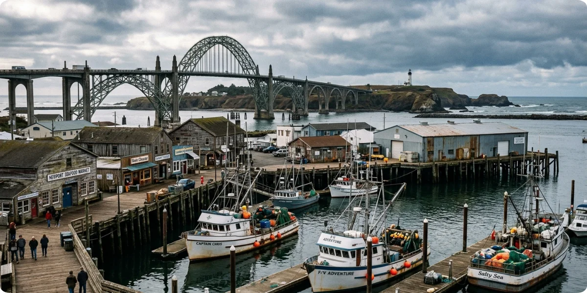
Newport is the central coast’s most complete stop. The historic Bayfront is a working fishing harbor lined with seafood restaurants and sea lions barking from the docks. Yaquina Head is a natural area with a tall lighthouse, tide pools and wildlife viewing, while the Oregon Coast Aquarium and other marine attractions make it a strong choice for families. Plan for a full day, and consider staying overnight.
7. Yachats
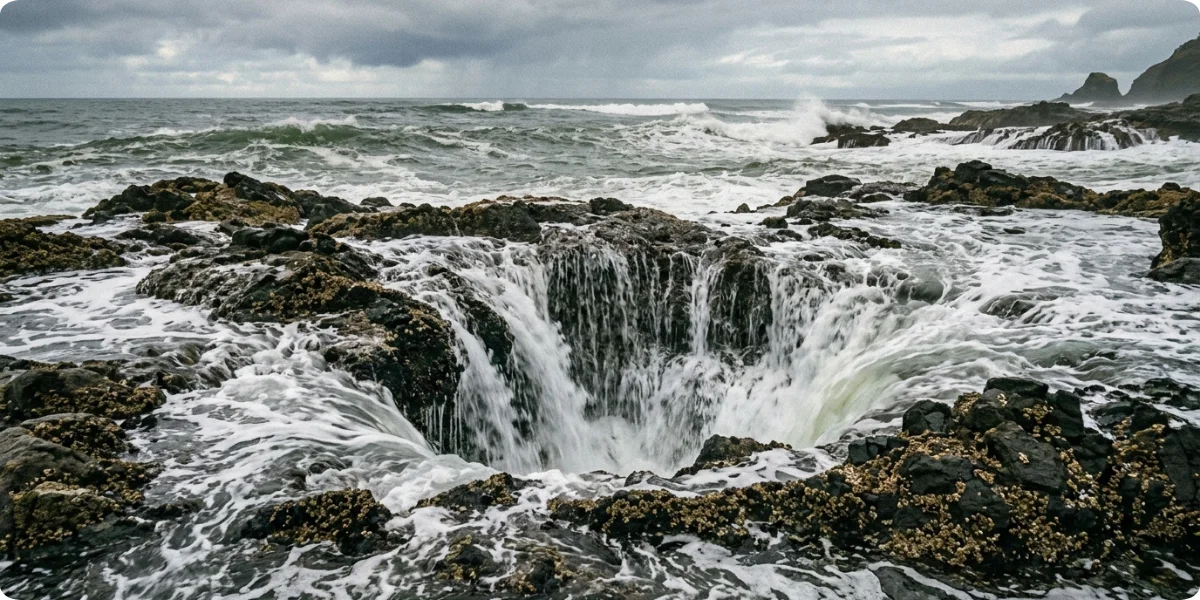
Yachats is a small, quiet village known for its rocky coastline, rugged tide pools and the nearby Cape Perpetua Scenic Area. The headland offers forest trails and ocean overlooks, and the famous Thor’s Well, a sea-carved sinkhole that fills and drains in dramatic fashion, is one of the most photographed features on the coast. Treat it with respect: it is dangerous when waves are large, and the safest approach is to stay back and watch from established viewpoints. Yachats is an excellent base for coastal hiking.
8. Florence
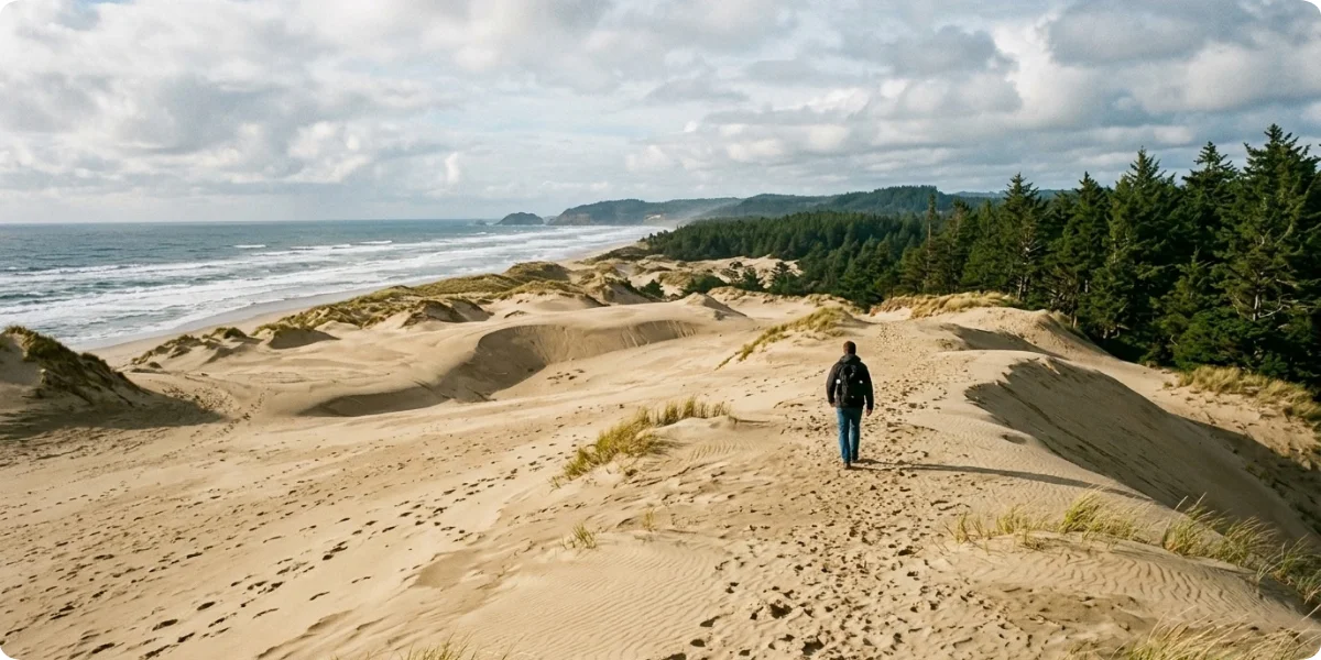
Florence sits on the Siuslaw River and marks the northern edge of the Oregon Dunes National Recreation Area, a huge expanse of coastal sand dunes managed by the Siuslaw National Forest. Old Town Florence has shops and restaurants along the water. About 13 miles north of town, the Heceta Head Lighthouse is one of the coast’s most photographed beacons. Between the river, the dunes and the lighthouse, Florence is easy to fill a day with.
9. Coos Bay
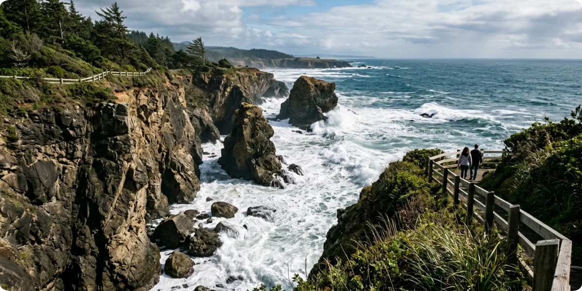
Coos Bay and its twin city North Bend are the largest urban area on the Oregon Coast and a launch pad for some of its most scenic state parks. Take the Cape Arago Highway out to Shore Acres State Park, known for its cliffside gardens and dramatic storm waves, and onward to Cape Arago, where seals and sea lions are often visible offshore. Between the coastal forests and beaches, this area rewards anyone who is willing to leave the main highway.
10. Bandon
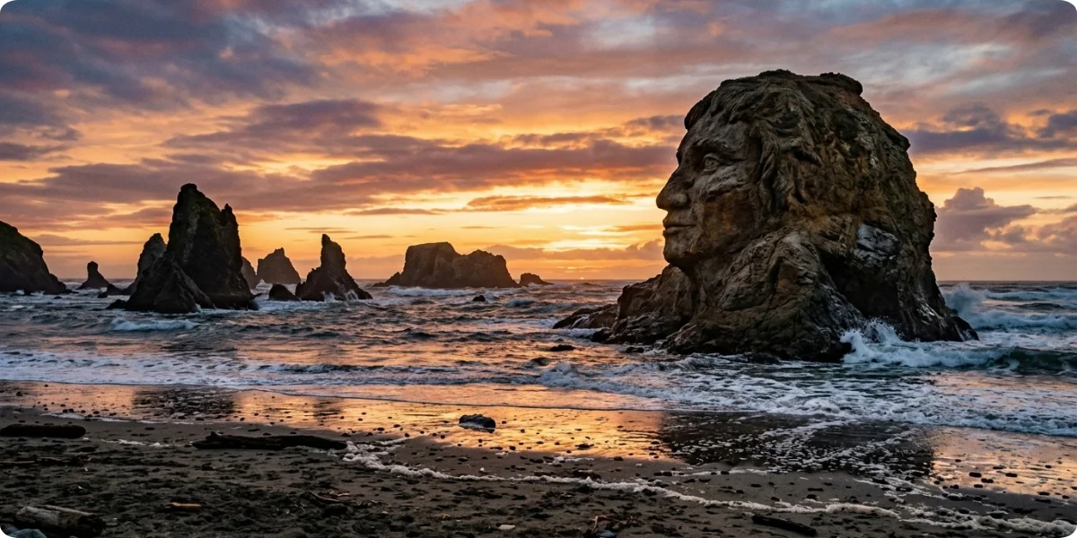
Bandon is where the south coast begins to feel wild. Face Rock and the surrounding sea stacks on Bandon Beach are among the most striking rock formations on the coast, and they are best at low tide. Old Town Bandon is compact and walkable, and the Coquille River Lighthouse at the mouth of the river adds a picturesque stop. The town is also known for cranberries and its world-famous golf resorts.
11. Port Orford
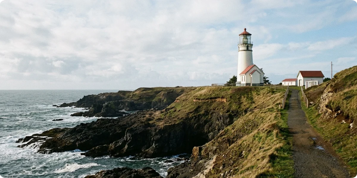
Port Orford is a small, unhurried fishing community and the closest base for Cape Blanco, the westernmost point in Oregon. The Cape Blanco Lighthouse is one of the coast’s most dramatic. Combine that with coastal viewpoints from Battle Rock and nearby headlands, plus hiking at Humbug Mountain State Park, and Port Orford rewards travelers who like quiet.
12. Gold Beach
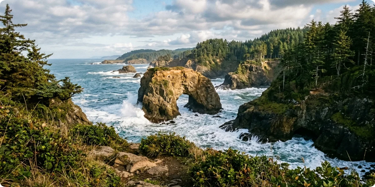
Gold Beach is where the Rogue River meets the Pacific, and jet-boat tours up the river are the signature activity. The town has long, quiet beaches and is the gateway to the most dramatic section of the south coast. Just north, Cape Sebastian has some of the best scenic viewpoints on the entire route.
13. Brookings
Brookings is the southern gateway, and it often enjoys milder weather than the rest of the Oregon Coast. North of town lies the Samuel H. Boardman State Scenic Corridor, a roughly 12-mile stretch of coastline with natural bridges, sea arches and hidden coves. Harris Beach State Park at the edge of town offers sheltered beaches, tide pools and camping. Brookings is a fitting finish to the Southern Oregon Coast.
Travel Oregon specifically highlights the Samuel H. Boardman State Scenic Corridor as a spectacular 12-mile stretch of Highway 101, while the broader Gold Beach-to-Brookings journey covers about 28 miles.
Best Scenic Stops Along Highway 101
Instead of thinking only in terms of towns, many travelers search for specific scenic stops. The table below sorts the best ones by whether they sit directly on the highway or require a short detour, which is the most useful thing to know when you are planning the day.
| Scenic stop | Nearest town | Directly on Highway 101 or a short detour? |
|---|---|---|
| Haystack Rock | Cannon Beach | Short detour into town, then a short walk to the beach |
| Ecola State Park | Cannon Beach | Short detour (a few miles off the highway) |
| Cape Kiwanda | Pacific City | Detour on the Three Capes Scenic Loop |
| Yaquina Head | Newport | Short detour north of Newport |
| Heceta Head Lighthouse | Florence/Yachats | Directly off the highway, with a short trail from the parking area |
| Cape Perpetua | Yachats | Directly off the highway, short drive to the viewpoint |
| Thor’s Well | Yachats | Off the highway within Cape Perpetua, short walk |
| Oregon Dunes | Florence to Coos Bay | Accessible from many points along the highway |
| Shore Acres State Park | Coos Bay | Detour of about 13 miles via Cape Arago Highway |
| Face Rock | Bandon | Short detour on the Beach Loop |
| Cape Blanco | Port Orford | Detour of about 5 miles off the highway |
| Cape Sebastian | Gold Beach | Directly off the highway, short drive up |
| Samuel H. Boardman State Scenic Corridor | Brookings | Directly along the highway, with multiple pullouts |
Haystack Rock is the most recognizable symbol of the Oregon Coast and deserves a visit at low tide. Ecola State Park adds forested lookouts and a classic view back toward Cannon Beach. At Cape Kiwanda, sandstone cliffs meet a massive dune that visitors climb for sunset views. Yaquina Head combines a lighthouse with tide pools and seabird colonies, and Heceta Head provides the cliffside postcard shot. Cape Perpetua gives you a forest, a viewpoint and a sea-carved landscape in a single stop, and Thor’s Well is the highlight if conditions are safe.
The Oregon Dunes are a wholly different environment, with sand hills, forest islands and lakes behind the shoreline. Shore Acres is at its best when winter storms push big surf against the cliffs, Face Rock is the signature stop in Bandon, and Cape Blanco feels truly remote. Cape Sebastian and the Samuel H. Boardman corridor finish the route with some of the finest coastal views anywhere on the West Coast.
Best Beaches on Highway 101 Oregon Coast
All of Oregon’s ocean beaches are open to the public, which makes beach-hopping a natural part of any Highway 101 trip. Many state park parking areas require a day-use permit or fee, so check the Oregon State Parks website for current requirements before you go.
1. Northern Oregon Coast Beaches
Cannon Beach is the signature north coast beach, with Haystack Rock, tide pools and a wide, walkable shore. Seaside is flat, easy and family friendly, with plenty of parking and nearby services. Manzanita has a long, wide stretch of sand below Neahkahnie Mountain and a quieter feel than Cannon Beach. Rockaway Beach is a lively, down-to-earth beach town with long sand and easy access.
2. Central Oregon Coast Beaches
Lincoln City’s beaches are wide and good for kites and long walks. The Newport area beaches include Nye Beach, a walkable shoreline in town, and quieter options just south. Yachats is a better choice for rocky shore exploration and tide pools than for sunbathing. Florence has access to the sand of the Oregon Dunes and the broad beaches nearby.
3. Southern Oregon Coast Beaches
Bandon Beach is famous for sea stacks that rise from the surf, and it is spectacular at low tide and sunset. Gold Beach has long, uncrowded stretches of sand. Harris Beach at Brookings is a sheltered cove with tide pools and a large offshore island that hosts nesting seabirds. The Brookings area beaches also include hidden coves along the Boardman corridor, usually reached by short trails.
4. Practical Beach Tips
Parking at the most popular beaches fills up early on summer weekends, so arriving in the morning is the easiest fix. Beach access varies from paved walkways to steep trails, so check the access description before you go if you have mobility needs. Hiking options range from short beach walks to cliff trails, and tide pools are best explored at low tide, using tide tables from NOAA Tides and Currents. Photographers will find the best light in the first and last hours of the day. Family suitability is highest at Seaside, Lincoln City, Rockaway Beach and Harris Beach, while rocky and exposed beaches such as Yachats require more caution with children. Always keep an eye on the ocean: sneaker waves, rising tides and floating logs are real hazards on Oregon beaches.
Best Lighthouses Along Highway 101
Travel Oregon identifies seven public lighthouses along the Oregon Coast. Here they are from north to south.
| Lighthouse | Location | Why visit |
|---|---|---|
| Cape Meares Lighthouse | Near Tillamook (Three Capes Loop) | Short, historic lighthouse on a headland with sea views |
| Yaquina Bay Lighthouse | Newport | Historic lighthouse that also served as a residence |
| Yaquina Head Lighthouse | Newport | The tallest lighthouse on the Oregon Coast, set in a natural area with tide pools |
| Heceta Head Lighthouse | Between Yachats and Florence | Scenic cliffside setting and one of the most photographed beacons |
| Umpqua River Lighthouse | Winchester Bay (near Reedsport) | South Coast landmark with views of the dunes and river |
| Coquille River Lighthouse | Bandon | Beach and river views at the river mouth |
| Cape Blanco Lighthouse | Port Orford | Dramatic setting at Oregon’s westernmost point |
A note on Tillamook Rock Lighthouse: you can see this iconic offshore lighthouse from viewpoints near Cannon Beach, notably Ecola State Park, but it is a decommissioned lighthouse on an offshore rock and is not open to the public, so it is not among the seven public lighthouses. Hours and tour availability at the public lighthouses vary by season, so check with the managing agency (state parks, the Bureau of Land Management at Yaquina Head, or local friends groups) before you plan around a tour.
Highway 101 Oregon Coast Road Trip Itineraries
The best itinerary depends on how much time you have and what you want from the coast. These five options are designed to be mixed and matched.
1-Day Highway 101 Oregon Coast Itinerary
Best for: travelers with limited time who want to see one scenic section of the coast without rushing.
If you only have a day, do not try to drive the whole coast. Pick a single section and give it your full attention. A popular option is Astoria to Cannon Beach to Tillamook: spend the morning in Astoria (Astoria Column and waterfront), walk Haystack Rock at Cannon Beach, then head to the Tillamook Creamery before returning. For a more rugged day, try Newport to Florence, which packs Yaquina Head, Cape Perpetua, Thor’s Well, Heceta Head and Sea Lion Caves into about 60 miles.
3-Day Highway 101 Oregon Coast Itinerary
Day 1: Astoria → Cannon Beach → Tillamook. Start with the Astoria Column and waterfront, drive to Cannon Beach for Haystack Rock and Ecola State Park, and finish at the Tillamook Creamery or the Three Capes Loop. Overnight in Cannon Beach or Tillamook.
Day 2: Lincoln City → Newport → Yachats. Walk the beach at Lincoln City, spend the afternoon in Newport (Bayfront, Yaquina Head and the aquarium), then continue to Yachats for sunset. Overnight in Yachats.
Day 3: Florence → Oregon Dunes → Southern Coast. Visit Cape Perpetua and Heceta Head on the way to Florence, spend time in the Oregon Dunes, and drive as far south as time allows, ideally to Coos Bay or Bandon. This is a taster of the coast, so expect to leave some of the south for another trip.
5-Day Highway 101 Oregon Coast Itinerary
Break the route into manageable sections of about 70 to 90 miles per day. A workable split is Day 1 Astoria and Cannon Beach, Day 2 Tillamook, Three Capes Loop and Lincoln City, Day 3 Newport and Yachats, Day 4 Florence, Oregon Dunes and Coos Bay, and Day 5 Bandon, Port Orford and Gold Beach, with a night in Gold Beach or Brookings. This pace gives you time at the main stops without the fatigue of long driving days.
7-Day Highway 101 Oregon Coast Road Trip
A week lets you cover the coast slowly with overnight stops at each major hub. Consider two nights in Cannon Beach or Astoria, one in Lincoln City or Pacific City, two in Newport or Yachats, one in Florence or Coos Bay, and a final night in Bandon, Gold Beach or Brookings. You gain time for tide pooling, hikes, a dune session, a jet-boat trip on the Rogue River and unplanned stops at viewpoints that catch your eye.
10-Day Oregon Coast Highway 101 Road Trip
Ten days is ideal for travelers who want hikes, beaches, viewpoints and detours. Spend two nights in the Astoria–Cannon Beach area, one around Tillamook and the Three Capes, one in Lincoln City or Depoe Bay, two in Newport and Yachats, one or two in Florence and the dunes, one in Coos Bay for Shore Acres and Cape Arago, one in Bandon, one in Port Orford for Cape Blanco, and the last night in Gold Beach or Brookings for the Boardman corridor. With this pace you can afford a rest day or a weather buffer.
Highway 101 Oregon Coast: North vs. Central vs. South
If you cannot do the whole coast, choosing the right region matters. Use the table to decide, and read the guidance below.
| Region | Best for | Highlights |
|---|---|---|
| North Coast | First-time visitors | Cannon Beach, Astoria, Seaside |
| Central Coast | Lighthouses and scenery | Newport, Yachats, Florence |
| South Coast | Rugged scenery | Bandon, Gold Beach, Brookings |
If you have 1–2 days, choose the North Coast if you want classic Oregon Coast scenes, easy access from Portland and a wide range of restaurants and lodging. If you have 3–4 days, the Central Coast is the strongest choice, because it concentrates lighthouses, tide pools, aquariums, forest trails and the dunes in a relatively compact stretch. If you have 5+ days or want solitude, add the South Coast, where the scenery is wilder, the towns smaller and the crowds thinner, although distances between services are longer. Travelers who want the full experience should plan to cover all three, ideally from north to south so the ocean stays on the passenger side of the car.
Best Scenic Detours From Highway 101
These detours are what separate a generic drive from a memorable one.
Three Capes Scenic Loop (near Tillamook) is a roughly 40-mile route linking Cape Meares, Cape Lookout and Cape Kiwanda, and it offers a quieter, more varied alternative to the highway. Cape Perpetua (near Yachats) is the highest viewpoint you can drive to on the Oregon Coast and has forest trails, tide pools and sea-carved features. Cape Arago (near Coos Bay) combines Shore Acres State Park with wildlife viewing at Simpson Reef. Bandon Beach Loop takes you past Face Rock and the surrounding sea stacks. Cape Blanco is a long, quiet side trip to the westernmost point in Oregon. The Old Coast Road (south of Gold Beach) is a former highway alignment that offers a quieter, slower route with wide views and is best for travelers who do not mind narrow roads. The Samuel H. Boardman State Scenic Corridor is easily approached from the highway, with numerous small pullouts and trails to natural bridges and hidden beaches.
Travel Oregon recommends several short side trips from Highway 101, including Bandon’s Beach Loop, Cape Blanco, Otter Point and the Cape Arago area.
How Long Does It Take to Drive Highway 101 in Oregon?
Short answer: Driving the full 363-mile route nonstop takes roughly 10–12 hours. A comfortable road trip takes 3–5 days, and a slow, scenic trip takes 7 days or more.
- Nonstop driving: approximately 10–12 hours
- Comfortable road trip: 3–5 days
- Slow scenic road trip: 7+ days
The nonstop estimate, which Travel Oregon gives for the 363-mile Pacific Coast Scenic Byway, is a baseline and not a realistic plan. In practice, your actual trip will take longer because of viewpoints, beach walks, hikes, meals, wildlife stops, photography, detours and weather. Whale watching in Depoe Bay, a tide-pool session at Yachats or a sunset at Cape Kiwanda can each easily consume half a day. Summer traffic through towns where the highway is the main street adds more time, and fog or heavy rain can slow the route further. Build slack into your schedule instead of filling every hour.
Best Time to Drive Highway 101 Oregon Coast
1. Spring
Spring brings wildflowers, waterfalls and whale watching as gray whales migrate north, though the weather is variable and showers are common. It is a good season for travelers who value green scenery and smaller crowds.
2. Summer
Summer offers longer daylight and the driest conditions, which makes it the most popular season for beaches, but it is also the busiest travel period. Book lodging and campsites well in advance and plan to start early at popular viewpoints. For seasonal ideas beyond the coast, see our guide to the best places to visit in August.
3. Fall
Fall brings fewer crowds, dramatic coastal weather and good photography, with lower-angle light and fewer visitors. Many experienced Oregon Coast travelers consider September and early October a sweet spot. If you are comparing months, our roundup of the best places to visit in October is a helpful companion.
4. Winter
Winter is about storm watching, dramatic waves and fewer visitors, but it also means potentially difficult driving conditions. The same storms that make Shore Acres and Depoe Bay spectacular can also bring heavy rain, wind and occasional road delays. If you travel in colder months, pair this guide with our list of the best places to visit in November or February for wider winter planning.
5. Best Overall Time
Late spring through early fall is usually the easiest window for a classic road trip: more daylight, generally gentler driving and better access to trails and viewpoints. Winter offers a completely different coastal experience that suits flexible, weather-aware travelers who value drama and solitude over sunshine.
Highway 101 Oregon Coast Weather
Oregon Coast weather is famously changeable. Rain is most frequent from fall through spring, wind can be strong at exposed headlands in any season, and fog is common, especially in summer mornings, when coastal marine layers can hide the views until midday. Coastal temperatures are mild and fairly stable compared with inland Oregon, with summer days often in the 60s °F and winter days commonly in the 40s and 50s °F, though conditions vary by location. Summer conditions can be sunny and clear, but you should still expect cool evenings and breezy beaches. Winter storms can deliver heavy rain and large surf.
Because forecasts can change quickly, never assume perfect weather. Check the forecast and road conditions before each day’s drive, and keep alternatives ready, such as a museum, an aquarium or a coffee shop, in case the weather closes in. The National Weather Service offers coastal forecasts and warnings, and Oregon DOT’s TripCheck (see below) shows road conditions.
Is Highway 101 Oregon Coast Difficult to Drive?
Short answer: No, Highway 101 is a paved, major state highway that most drivers can handle, but it has curves, hills, cliffside sections and changing weather. Slow down in the rain, use designated pullouts and give yourself extra time.
The route is mostly a two-lane road, and the stretch between Brookings and Gold Beach includes the highest bridge in Oregon and the highest point on the highway in the state. Expect curves and hills, particularly in the south, coastal cliffs with limited shoulders, narrow sections in some bridges and tunnels, and rain and fog that reduce visibility. Night driving can be tiring on unlit stretches, so plan to arrive at your destination before dark. Large vehicles and RVs should expect slower speeds through towns and on winding sections, and should use pullouts to let traffic pass. Take advantage of pullouts and viewpoints instead of stopping on the shoulder.
1. Safety Tips
- Slow down in wet conditions.
- Avoid stopping in unsafe roadside areas.
- Use designated viewpoints and pullouts.
- Check road conditions before each driving day.
- Don’t drive distracted.
- Keep fuel topped up in remote sections.
For current road conditions, Oregon DOT directs travelers to TripCheck, which provides road conditions, weather information, travel information and traffic cameras. Knowing the local tsunami evacuation signage is also wise for anyone sleeping near the shore, and beachgoers should never turn their backs on the surf.
Where to Stay Along Highway 101
Choose your bases by region instead of picking lodging town by town, and aim for a stop every 60 to 90 miles so each day has a reasonable driving distance.
1. Northern Coast
Astoria has historic hotels and waterfront stays and is good for travelers interested in history. Seaside is the easiest option for families, with many mid-range hotels close to the beach. Cannon Beach is the premium choice, with boutique inns and oceanfront lodging that suits couples, though prices run higher and summer availability is tight.
2. Central Coast
Lincoln City has a large number of oceanfront hotels and vacation rentals, making it a good value for families. Newport is the best all-around base, with options from budget motels to Bayfront inns. Yachats offers small oceanfront lodgings and vacation rentals for a quieter stay, and Florence is a practical base for the dunes and has plenty of mid-range hotels.
3. Southern Coast
Coos Bay has the widest range of services in the southern half and works well for a one-night stop. Bandon has oceanfront lodging, cottages and golf-oriented resorts. Gold Beach is the practical base for Rogue River trips, and Brookings is the natural overnight at the end of the route.
4. Lodging Guidance
For oceanfront stays, book months ahead for summer and holiday weekends. Budget accommodation is easiest to find in Newport, Lincoln City, Florence and Coos Bay. Family-friendly areas include Seaside, Lincoln City and Newport, while couples often prefer Cannon Beach, Yachats and Bandon. Camping and RV travel are well served by Oregon’s state parks, and you can reserve campsites through Oregon State Parks, though popular parks fill early.
Where to Eat Along Highway 101
The Oregon Coast is a seafood destination, and the best strategy is to look for the type of food you want instead of chasing a single restaurant. Fresh seafood is the headline, with Dungeness crab in season, salmon, rockfish and halibut on many menus. Oregon oysters are a local specialty, especially from the bays on the north and central coast. Fish and chips and clam chowder are the classic casual meals, and you will find them at everything from dockside shacks to sit-down restaurants. Local bakeries and coffee shops are plentiful in towns such as Cannon Beach, Yachats and Bandon, and coastal breweries are common in the larger towns.
Newport’s Bayfront is a strong choice for working-harbor seafood, Astoria for waterfront dining and craft beer, and Tillamook for cheese, ice cream and dairy. If you are searching for the best restaurants on Highway 101 Oregon Coast, check recent reviews and posted hours before you arrive, because small-town restaurants often have limited days and seasonal schedules.
Gas Stations, Groceries and Essentials
This is one of the most useful practical sections for planning a safe, stress-free trip.
Fuel is available in most coastal towns, but stations become less frequent in some southern stretches and between smaller communities. Fill up whenever you pass a larger town such as Coos Bay, Bandon or Gold Beach. Some stations in Oregon may still have attendants who pump fuel, so policies vary by location. Groceries are easiest to find in the larger towns (Astoria, Lincoln City, Newport, Florence, Coos Bay, Bandon and Brookings), so stock picnic supplies there. ATMs and restrooms are common in towns but scarce at remote viewpoints, so plan accordingly. Cell coverage can be patchy in forested or remote areas, so download offline maps and key reservations before you leave a major town.
For EV travelers, charging infrastructure exists in major coastal towns and along the main routes, but you should still plan charging stops in advance and have a backup. Travel Oregon has published an Oregon Coast electric road-trip route with charging stops, and apps such as PlugShare can help you check current availability.
Highway 101 Oregon Coast Packing List
1. Essentials
- Waterproof jacket
- Comfortable walking shoes
- Layers
- Daypack
- Water bottle
- Sunglasses
- Camera
- Phone power bank
- Offline maps
2. For Beach Stops
- Extra socks
- Small towel
- Waterproof bag
- Warm layers
If you are comparing outdoor road-trip destinations, our Joshua Tree guide offers a useful contrast for desert packing, because the clothing and water needs are very different.
Highway 101 Oregon Coast Travel Tips
- Don’t try to rush the entire coast.
- Start early at popular viewpoints.
- Keep extra time for scenic stops.
- Check weather before long drives.
- Fill your tank before remote sections.
- Download offline maps.
- Bring layers even in summer.
- Use designated viewpoints and pullouts.
- Check park conditions before visiting.
- Build flexibility into your itinerary.
Common Highway 101 Oregon Coast Mistakes
Mistake 1: Trying to drive the entire coast in one day. It is technically possible in 10–12 hours but defeats the purpose. Pick one section instead.
Mistake 2: Skipping the small coastal towns. Places such as Yachats, Port Orford and Pacific City often give the most memorable moments of the trip.
Mistake 3: Not planning fuel stops. Refuel before you need to, particularly on the South Coast.
Mistake 4: Ignoring weather. Fog, wind, and storms can change a day’s plan. Build in alternatives.
Mistake 5: Spending too little time in Southern Oregon. Many travelers stop at Florence or Coos Bay and miss Bandon, Cape Blanco, Gold Beach, and the Boardman corridor.
Mistake 6: Treating every attraction as a quick photo stop. The best coastal experiences, from tide pools to trails, reward a longer visit.
Mistake 7: Not checking road conditions. A quick look at TripCheck can save hours of detours.
Frequently Asked Questions About Highway 101 on the Oregon Coast
How long is Highway 101 along the Oregon Coast?
U.S. Highway 101 runs about 363 miles along the Oregon Coast, from the Columbia River near Astoria in the north to the California border near Brookings in the south. The same stretch is designated the Pacific Coast Scenic Byway, and driving it without stops takes roughly 10 to 12 hours.
How many days do you need for the Oregon Coast Highway 101?
Most travelers need three to five days to see the highlights comfortably, and seven or more days to enjoy hikes, beaches and small towns without rushing. Three days works for a focused trip covering one or two regions, while the full Astoria-to-Brookings route rewards a slower pace.
Where does Highway 101 start and end in Oregon?
Highway 101 in Oregon starts at the Washington border on the Astoria–Megler Bridge over the Columbia River, near Astoria, and ends at the California border south of Brookings. Along the way it follows the Pacific shoreline for most of the route, turning inland briefly in a few places.
Is Highway 101 Oregon Coast worth driving?
Yes. Highway 101 on the Oregon Coast is widely regarded as one of the best road trips in the United States, with public beaches, sea stacks, lighthouses, forests and small towns within short drives of each other. It is best for travelers who enjoy stopping often rather than racing through.
What are the best stops on Highway 101 in Oregon?
Top stops include Cannon Beach and Haystack Rock, Ecola State Park, Cape Kiwanda, Newport’s Yaquina Head, Heceta Head Lighthouse, Cape Perpetua and Thor’s Well, the Oregon Dunes near Florence, Bandon’s Face Rock and the Samuel H. Boardman State Scenic Corridor near Brookings.
What is the most scenic part of Highway 101 in Oregon?
Many travelers consider the stretch between Gold Beach and Brookings the most dramatic, especially the Samuel H. Boardman State Scenic Corridor, while the Cape Perpetua area near Yachats and the Cannon Beach area are also strong contenders. The best choice depends on whether you prefer remote cliffs or classic beach scenery.
Can you drive Highway 101 Oregon Coast in one day?
Technically yes, since nonstop driving takes roughly 10 to 12 hours, but it is not recommended. You would see the coast mostly through the windshield. If you only have one day, pick a single section, such as Astoria to Tillamook or Newport to Florence, and explore it properly.
What is the best month to drive Highway 101 in Oregon?
September and early October are often the sweet spot, offering lower crowds than midsummer, fairly settled weather and good light for photography. July and August are the driest and busiest months, while winter suits storm watchers who accept rain and wind. Conditions can change quickly in any month.
Is Highway 101 Oregon Coast safe?
Highway 101 is a major, paved state highway and generally safe, but it has curves, hills, cliffside sections, rain and fog. Slow down when wet, use designated pullouts, keep fuel topped up and check Oregon DOT’s TripCheck for current road conditions before you leave each day.
Which direction should you drive the Oregon Coast?
Most travelers drive north to south, from Astoria to Brookings, because the ocean stays on your right and pullouts and viewpoints are easier to enter. South to north works well too, especially if you are arriving from California, so start from whichever end connects better with your travel plans.
What towns should I stay in on Highway 101?
Cannon Beach suits first-time visitors and couples, Newport works well as a central base with attractions and restaurants, Yachats and Florence suit scenery and hiking, and Bandon or Gold Beach are good for the South Coast. Choose bases roughly every 60 to 90 miles to avoid long drives each day.
Are there gas stations along Highway 101?
Yes, fuel is available in most coastal towns along Highway 101, but some stretches, especially parts of the South Coast, have fewer stations, and hours can be limited. Fill up before leaving larger towns such as Coos Bay, Bandon or Gold Beach rather than waiting until the tank is low.
Can you drive Highway 101 in winter?
Yes. Highway 101 stays open year-round and many travelers enjoy winter for storm watching and quiet beaches. Expect rain, strong winds and occasional road delays from slides or flooding, so check TripCheck daily, pack warm waterproof layers and keep your schedule flexible.
What are the best beaches along Highway 101?
Highlights include Cannon Beach for Haystack Rock, Manzanita for wide sand and mountain views, Cape Kiwanda for sand dunes and sea stacks, Yachats for tide pools and rugged shoreline, Bandon Beach for sea stacks at low tide, and Harris Beach near Brookings for sheltered coves and wildlife.
Final Verdict: Is Highway 101 Oregon Coast Worth It?
Yes, and for a wider range of travelers than most scenic drives. The Highway 101 Oregon Coast route suits road-trippers who like to stop often, photographers chasing sea stacks and lighthouses, families who want easy beaches, hikers who enjoy headland trails and couples looking for quiet small-town stays. Its variety is its greatest strength in a single trip you can move from busy beach towns and working fishing harbors to sand dunes, temperate forest and remote cliffs.
What separates a good Oregon Coast trip from a great one is pace. The people who enjoy it most are rarely those who tick off the most miles, but those who linger at a tide pool, wait for the fog to lift at a viewpoint or take the detour to a lighthouse at the end of a headland. If you do not have time for the entire coast, choose a single section and do it well the north for classic scenery, the central coast for lighthouses and hiking, or the south for wild, uncrowded cliffs. Whichever you pick, leave room in the schedule, check the weather and road conditions, and let the coast set the rhythm.

Arman Ashraf is a content writer focused on travel and tourism. He creates practical, well-researched travel guides, destination articles, and travel tips designed to help readers plan trips with greater confidence. His work combines clear, engaging writing with SEO best practices, covering destinations, things to do, travel planning, and useful advice for travelers. Arman is committed to producing helpful content that makes discovering and planning travel easier.