

A Route 66 map traces the historic highway from Chicago, Illinois, west to Santa Monica, California, across eight states Illinois, Missouri, Kansas, Oklahoma, Texas, New Mexico, Arizona and California. The road was removed from the U.S. Highway System in 1985, so a modern drive means stitching together preserved alignments, frontage roads and “Historic Route 66” signs rather than following one numbered highway. The National Park Service notes that the highway was decommissioned in 1985 yet still lives on as “Route 66” in the public imagination, and 2026 marks its 100th anniversary.
This guide walks the route east to west, then breaks it into drivable sections with distances, overnight suggestions and planning advice. If you are still sketching the bigger picture of your trip, our road trip guides are a good companion to this map.
Quick answer: Route 66 runs from Chicago to Santa Monica through eight states. The commissioned length was 2,448 miles, and most sources round that to roughly 2,400 miles. Your real odometer reading will differ depending on which original alignments, detours and attractions you choose.
Route 66 Map at a Glance
| Route 66 detail | Information |
|---|---|
| Historic starting point | Chicago, Illinois |
| Historic western endpoint | Santa Monica, California |
| Approximate length | About 2,400 miles (2,448 as originally commissioned) |
| States crossed | 8 |
| Highway designation | U.S. Route 66 |
| Decommissioned | 1985 |
| Shortest state section | Kansas, about 13 miles |
| Halfway marker | Adrian, Texas |
Two facts explain most of the confusion people have with maps of this road. First, the route was realigned many times, so older and newer paths sit side by side. Second, the western end moved: the road originally finished in Los Angeles and was later extended to the coast at Santa Monica.
Route 66 Map: From Chicago to Santa Monica
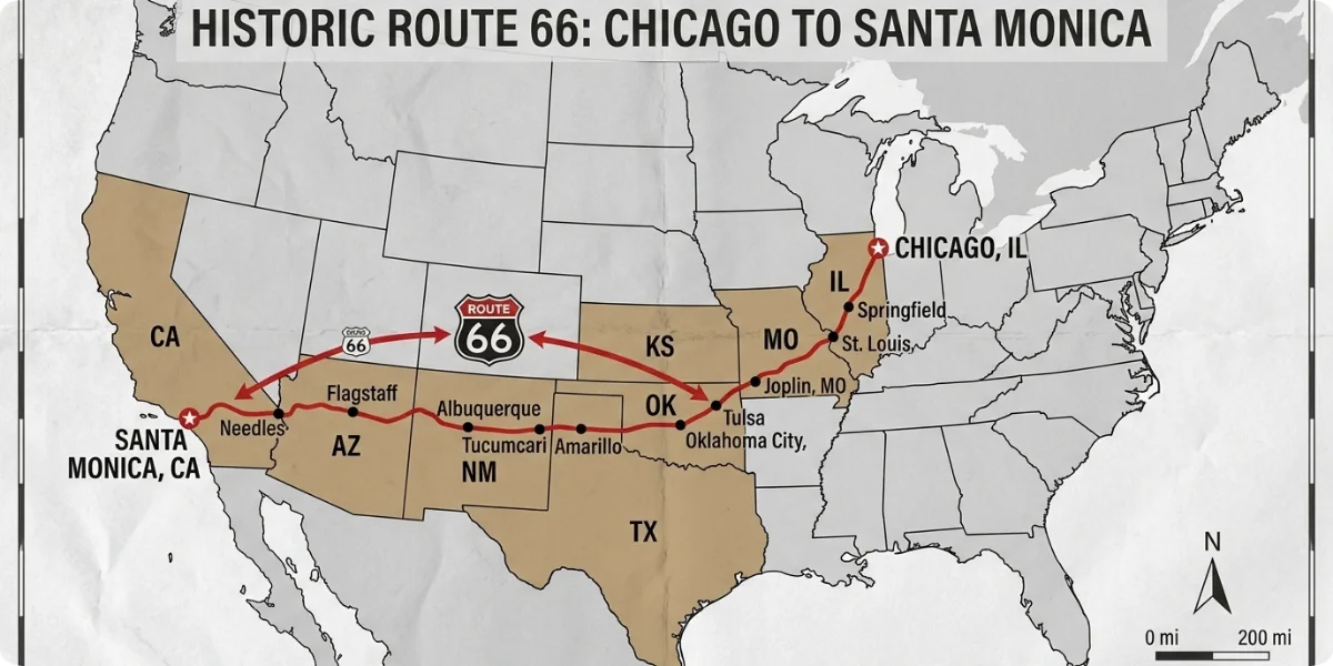
Read the route as a long westward arc. It leaves the Great Lakes, crosses the Mississippi at St. Louis, climbs through the Ozarks, runs across the southern Plains, and then enters the high desert of the Southwest before dropping into California. For an overview of towns by state, the Route 66 Road Trip travel guides maintain a clickable index.
1. Illinois
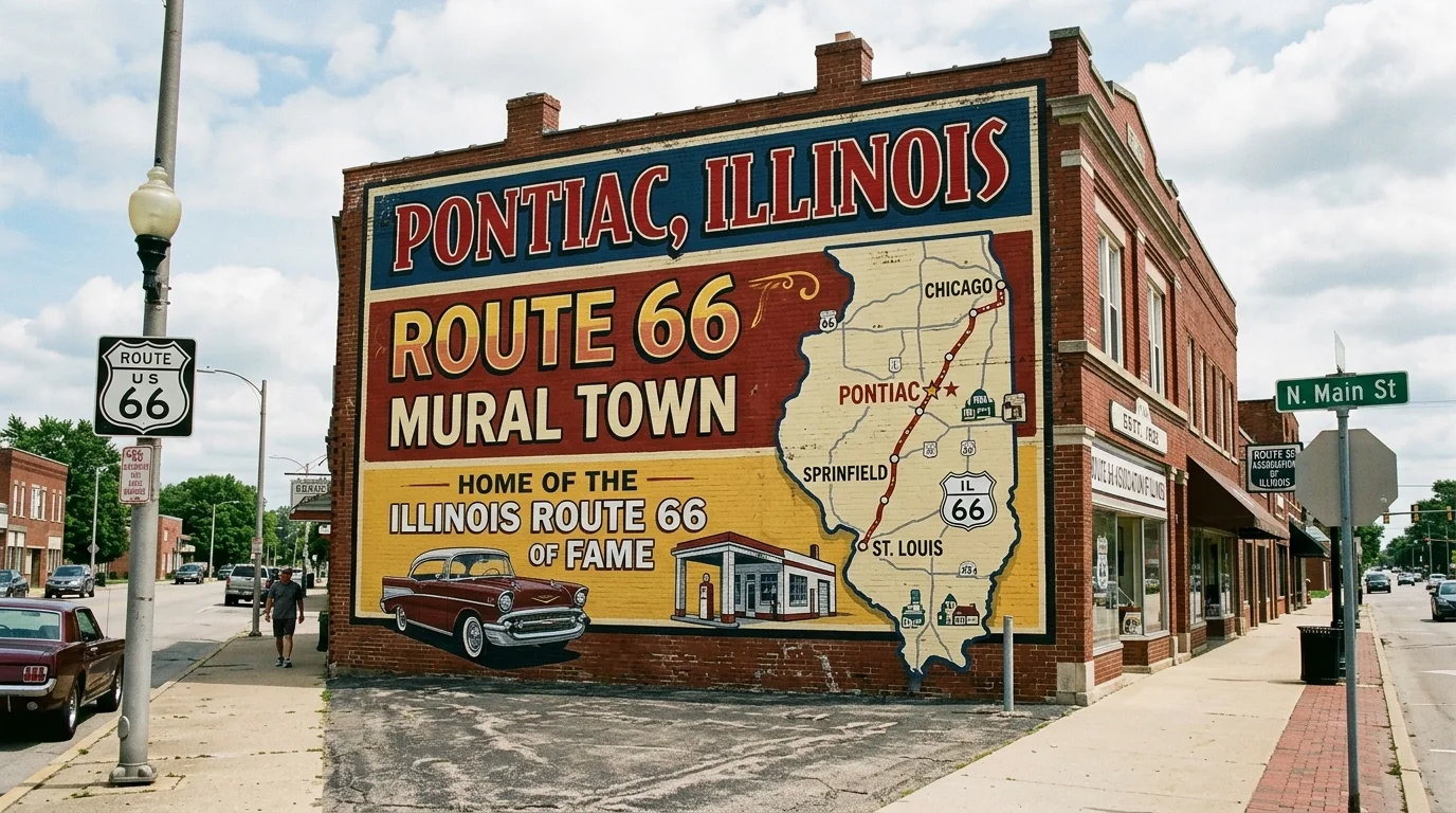
Illinois is where the road begins, and the state has marked it as a scenic byway of roughly 300 miles. Start downtown in Chicago, where Lou Mitchell’s has been feeding travelers since 1923, then head southwest through Joliet, Pontiac, Springfield and Litchfield.
- Joliet: a good place to pick up maps and advice at the area’s Route 66 welcome center.
- Pontiac: home to the Route 66 Association of Illinois Hall of Fame & Museum and dozens of murals in the downtown streets.
- Springfield: pair roadside icons such as the Cozy Dog Drive-In with Abraham Lincoln sites.
- Litchfield: the Ariston Café (open since 1924) and the Litchfield Museum & Route 66 Welcome Center anchor the town, as described on the Looking for Lincoln Route 66 page.
- Surviving road sections: the old brick roadbed near Auburn is one of the best-known preserved stretches.
For official trip-planning resources, use the Illinois Route 66 Scenic Byway site.
2. Missouri
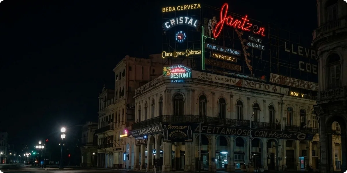
Missouri’s route crosses the Mississippi at St. Louis and then follows the edge of the Ozarks through Cuba, Lebanon and Springfield, before leaving the state near Carthage and Joplin. This is motel, diner and mural country. Cuba is known for its wall paintings, Lebanon for classic motor-court architecture, and Springfield is often called the place where the highway number was settled in 1926. Plan on slower speeds here, because much of the original road runs as a two-lane outer road beside the interstate.
3. Kansas
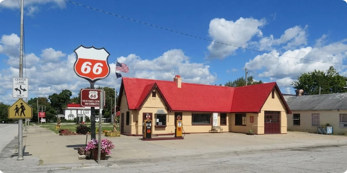
Kansas gets the shortest share of the trip only about 13 miles, according to Britannica’s Route 66 entry. The section touches Galena, Riverton, and Baxter Springs. You can drive it in under half an hour, but it is worth a slow roll for the restored service station in Galena and the small-town streetscape in Baxter Springs.
4. Oklahoma
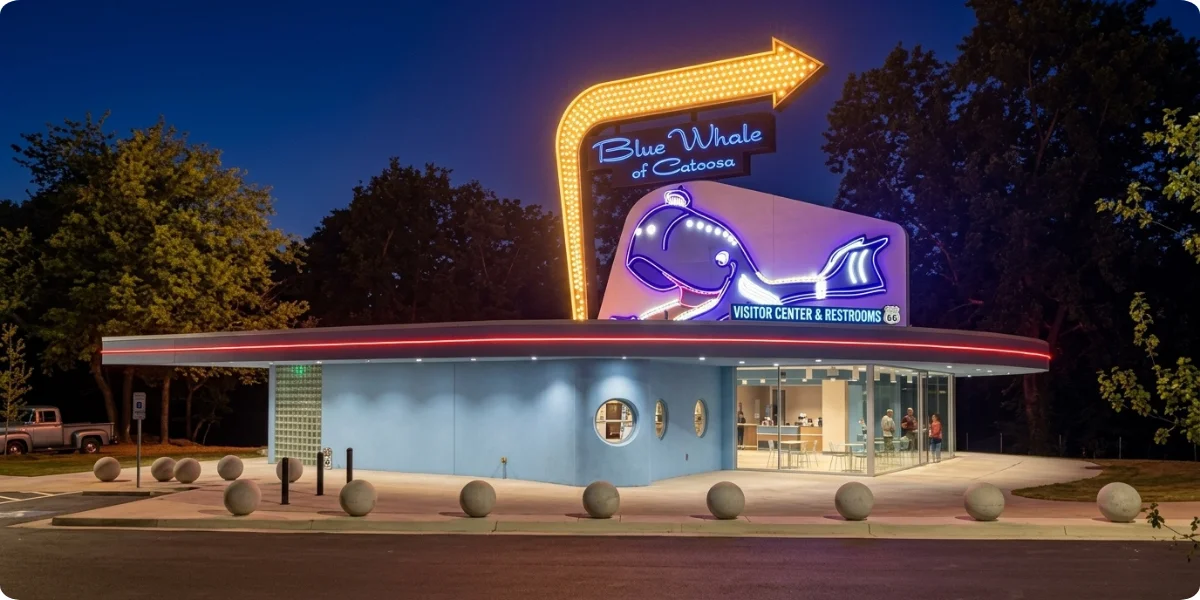
Oklahoma has more miles of original Route 66 than any other state, and the Oklahoma Route 66 Association describes roughly 400 drivable miles, with a free printed Oklahoma Route 66 Trip Guide that only costs shipping. Cities and towns to plan around:
- Miami: the first Oklahoma stop, with a classic narrow “Ribbon Road” segment nearby.
- Tulsa: art-deco architecture and vintage neon.
- Oklahoma City: a big-city break before the Plains.
- Clinton and Elk City: both have Route 66 museums, making them natural stops for history.
Oklahoma matters for another reason: the highway’s most influential champion, Cyrus Avery, was an Oklahoman. For travelers, that translates into the best-preserved, best-signed state on the whole route.
5. Texas
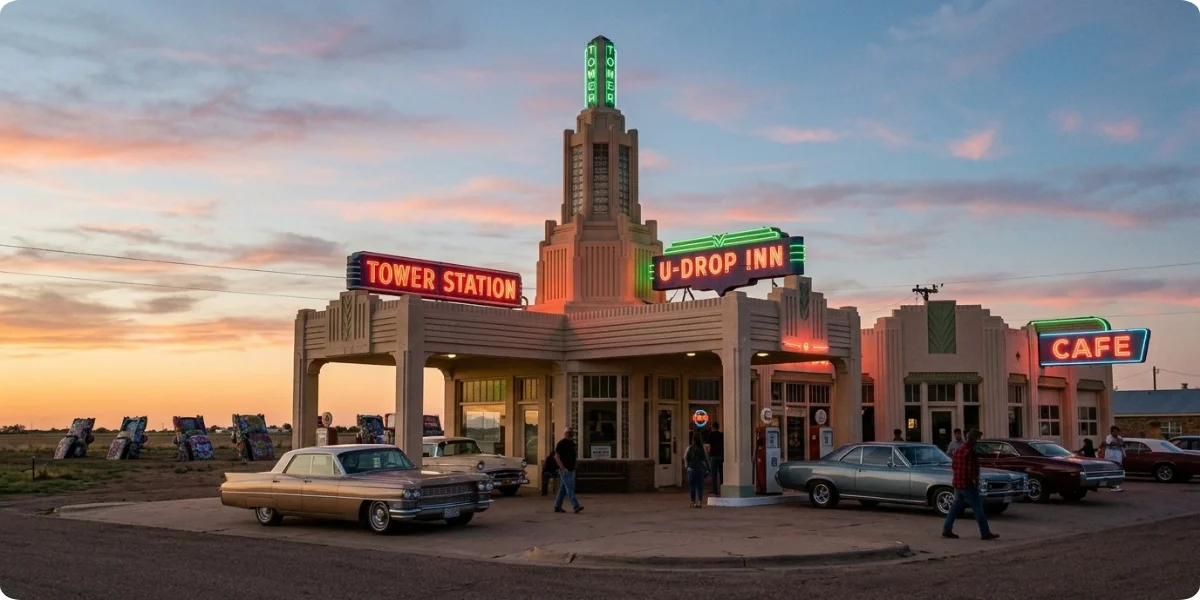
Texas is short and flat but packed with landmarks. Cross the Panhandle from east to west through Shamrock, McLean, Amarillo, and Adrian.
- U-Drop Inn (Shamrock): a 1930s art-deco station and café that inspired a building in the animated film Cars.
- Devil’s Rope Museum and Route 66 Museum (McLean): one of the larger collections of road memorabilia in the state, as covered in this Texas Route 66 day-trip feature.
- Cadillac Ranch (Amarillo): a row of old Cadillacs buried nose-down in a field, repainted by visitors constantly.
- Route 66 midpoint area (Adrian): the Midpoint Café marks the traditional halfway point between Chicago and Santa Monica, a milestone local TV coverage describes as a rite of passage for travelers.
6. New Mexico

New Mexico is where the landscape turns to mesas, red rock and big sky. Travel through Tucumcari, Santa Rosa, Albuquerque, Grants and Gallup. Neon-lit motels in Tucumcari, the long run of Central Avenue in Albuquerque and the trading-post culture around Gallup give the state a different personality from the Plains. Many roadside towns here feel half-asleep, and that quiet is part of the appeal.
7. Arizona
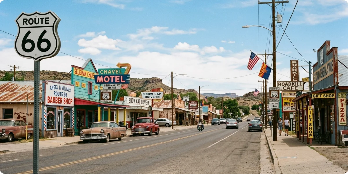
Arizona offers the route’s most dramatic scenery. Key towns are Holbrook, Winslow, Flagstaff, Seligman and Kingman. According to the National Park Service’s Route 66 Arizona overview, the state’s section earned scenic-byway status in 1994 and All-American Road status in 2009.
- Petrified Forest area: the only national park that contains a stretch of the historic road.
- Meteor City: a roadside trading post (now closed) between Winslow and Flagstaff, close to Meteor Crater.
- Historic Route 66 towns: Seligman is widely credited as the birthplace of the road’s revival, and Kingman’s museum tells the highway’s story.
8. California
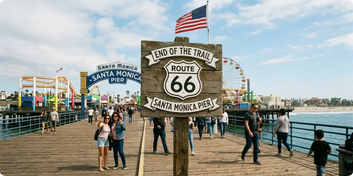
California is the final push: Needles, Barstow, Victorville, San Bernardino, the Pasadena area and finally Santa Monica. Expect the Mojave Desert for the first half and dense suburbs for the second. The historic endpoint is Santa Monica, where the route met the Pacific after being extended from Los Angeles in 1936, which is why you will find different “end of the road” claims on different maps.
Route 66 Map by State
| State | Major Route 66 stops | What to see |
|---|---|---|
| Illinois | Chicago, Springfield, Pontiac | Murals, diners, preserved brick road |
| Missouri | St. Louis, Cuba, Lebanon | Motor courts, murals, roadside museums |
| Kansas | Galena, Riverton, Baxter Springs | The shortest state section (about 13 miles) |
| Oklahoma | Tulsa, Oklahoma City, Clinton | Museums, neon, the longest preserved stretch |
| Texas | Amarillo, Shamrock, Adrian | Cadillac Ranch, U-Drop Inn, the midpoint |
| New Mexico | Tucumcari, Albuquerque, Gallup | Neon motels, desert scenery, trading posts |
| Arizona | Winslow, Flagstaff, Seligman | Painted Desert, pine forest, revival-era towns |
| California | Needles, Barstow, Santa Monica | Mojave Desert and the Pacific finish |
Route 66 Map With Major Cities
You do not need to memorize every small town. These nine cities work as anchors for planning fuel, food, and rest.
1. Chicago
The starting point, on the shore of Lake Michigan. Most travelers begin near Grant Park downtown, and the city offers the widest choice of hotels and parking before the road gets quieter.
2. St. Louis
The Mississippi River crossing and the first major city after Illinois. It is a natural overnight if you left Chicago late.
3. Tulsa
Oklahoma’s Route 66 hub, with art-deco buildings and neon signs that survived the highway’s decline. Tulsa sits roughly two-fifths of the way along the route by mileage.
4. Oklahoma City
The state capital and the best option for a full rest day before the Panhandle crossing.
5. Amarillo
The Texas stop that bundles Cadillac Ranch, steakhouses and old-road neighborhoods. It sits close to the route’s midpoint.
6. Albuquerque
The largest city in New Mexico, with miles of Central Avenue following the original path and plenty of vintage signs.
7. Flagstaff
A mountain town at roughly 7,000 feet that doubles as a base for the Grand Canyon, Meteor Crater and the Petrified Forest.
8. Kingman
A practical Arizona base before the desert descent to the Colorado River, with a museum dedicated to the highway.
9. Santa Monica
The end of the line. Plan on parking near the pier and a photo at the end-of-the-trail sign.
Route 66 Map With Major Attractions
Only attractions that genuinely belong to Route 66 history are listed here.
1. Best Route 66 Attractions in Illinois
Route 66 Hall of Fame & Museum (Pontiac), the Cozy Dog Drive-In (Springfield), the Ariston Café (Litchfield) and the Gemini Giant “Muffler Man” in Wilmington.
2. Best Route 66 Attractions in Missouri
The murals of Cuba, classic motels such as those in Lebanon, and the Route 66 landmarks of Carthage and Joplin.
3. Best Route 66 Attractions in Oklahoma
The state’s Route 66 museums in Clinton and Elk City, the Blue Whale of Catoosa, and historic spots such as the Round Barn at Arcadia.
4. Best Route 66 Attractions in Texas
U-Drop Inn in Shamrock, the Route 66 museum in McLean, Cadillac Ranch in Amarillo and the Midpoint Café in Adrian. The ghost town of Glenrio, on the New Mexico line, shows what happened to roadside towns once the interstate arrived.
5. Best Route 66 Attractions in New Mexico
Tucumcari’s neon strip and the famous Texaco station at Route 66 and First Street, Central Avenue in Albuquerque, and the town centers of Grants and Gallup.
6. Best Route 66 Attractions in Arizona
Petrified Forest National Park, Meteor Crater near Winslow, the “Standin’ on the Corner” park in Winslow, downtown Flagstaff, the Seligman main street, the Kingman museum and the burro-filled town of Oatman. For a state-by-state breakdown, see this Arizona Route 66 landmark guide.
7. Best Route 66 Attractions in California
The Mojave stretch through Needles and Barstow, the Route 66 museums of the Victor Valley, the foothill towns toward Pasadena, and the Santa Monica Pier finish. If you plan to hike near Petrified Forest or camp on the way, browse our hiking and camping sections for ideas that fit a road-trip budget.
Historic Route 66 vs. Modern Route 66 Map
Route 66 is no longer an active U.S. Highway. The National Park Service confirms that U.S. Highway 66 was decommissioned in 1985, after interstate highways took over its traffic. Today you navigate with Historic Route 66 signs, state byway markers and preserved alignments. What this means in practice:
- Interstates replaced much of the original corridor, mainly I-55, I-44, I-40, and in California I-15 and I-10.
- Some original sections now run as frontage roads beside the interstate.
- A few segments are unpaved, closed, on private land or simply gone.
- Certain stretches are preserved as attractions rather than through routes.
- A good drive requires a paper or offline map plus a phone navigation app.
Why the Route 66 Map Can Look Different Today
Five things change what you see on a map:
- Realignments: the road moved many times. Britannica notes that removing the Santa Fe loop in 1937 cut over 100 miles from the route.
- Missing sections: parts were buried under interstates or abandoned.
- Private roads: some historic segments cross ranches or businesses.
- Interstate replacements: the official designation vanished, so general-purpose maps rarely label it.
- Preserved sections: places such as brick roadbeds are kept as short heritage drives.
The National Park Service runs a Route 66 preservation program that supports grants and technical help for historic road segments, buildings, and signs across all eight states.
How Long Is Route 66?
Historic Route 66 was approximately 2,400 miles long, running between Chicago and Santa Monica. The officially commissioned length was 2,448 miles, but realignments shortened the finished road, and modern travelers can end up with a longer or shorter total. Why mileage varies:
- Original alignments vs. modern routing: following every old loop adds distance, while sticking to interstates trims it.
- Detours: side trips to Santa Fe, the Grand Canyon or Oatman add miles quickly.
- Different measurement rules: one local news report on the Midpoint Café in Adrian cites a figure of 2,278 miles for the route and a halfway odometer reading of about 1,139. Always check how a source counts.
Short answer: Plan for 2,400 miles as a baseline, then add 10 to 20 percent for attractions and detours. Use our Distance Calculator to measure the legs you choose.
How Many Days Do You Need for Route 66?
Pick a pace based on how much time you want to spend out of the car. Our Trip Duration Calculator helps you turn daily mileage into a total schedule.
1. 7–10 Days
Fast-paced. Expect 250 to 350 miles a day, heavy use of interstate shortcuts and only short stops at the headline sights.
2. 10–14 Days
A balanced road trip. You can include museums, a half-day in each major city and a few of the quirky roadside stops.
3. 2–3 Weeks
Better for exploring towns and attractions. This pace leaves room for the Petrified Forest, Meteor Crater and a Santa Fe detour.
4. 3+ Weeks
Slow travel with extensive sightseeing. You can follow almost every original alignment, spend nights in historic motels and linger in small towns.
Route 66 Map: Best Stops for a Road Trip
| Stop | Why it earns a place on the map |
|---|---|
| Chicago | The traditional starting line and a strong food city. |
| Springfield, IL | Lincoln history plus the Cozy Dog and drive-in culture. |
| St. Louis | A major river crossing and a convenient first overnight. |
| Tulsa | The best surviving neon and art-deco streetscape in Oklahoma. |
| Oklahoma City | Big-city services and easy access to Clinton and Elk City. |
| Amarillo | Cadillac Ranch and Texas steakhouses near the midpoint. |
| Albuquerque | A long stretch of Central Avenue with vintage motels. |
| Santa Fe-area detour | The pre-1937 path ran through here, so it adds history. |
| Flagstaff | A mountain base for Meteor Crater and Grand Canyon access. |
| Seligman | Often called the birthplace of the Route 66 revival. |
| Kingman | A good rest stop before the desert run. |
| Santa Monica | The Pacific finish and the end-of-trail sign. |
Route 66 Road Trip Map by Distance
The figures below are rounded estimates for planning. Confirm exact distances in your navigation app, since old alignments add miles.
1. Chicago to St. Louis
- Approximate distance: about 300 miles
- Driving time: 5 hours on the interstate, 7 to 9 hours using original alignments
- Key stops: Joliet, Pontiac, Springfield, Litchfield
- Suggested overnight: Springfield, Illinois
2. St. Louis to Oklahoma City
- Approximate distance: about 500 miles
- Driving time: 7.5 to 9 hours
- Key stops: Cuba, Lebanon, Springfield (MO), Carthage, Joplin, the short Kansas stretch, Tulsa
- Suggested overnight: Tulsa, Oklahoma
3. Oklahoma City to Amarillo
- Approximate distance: about 260 miles
- Driving time: around 4 hours
- Key stops: Clinton, Elk City, Shamrock, McLean
- Suggested overnight: Amarillo, Texas
4. Amarillo to Albuquerque
- Approximate distance: about 285 miles
- Driving time: 4.5 to 6 hours
- Key stops: Adrian, Glenrio, Tucumcari, Santa Rosa
- Suggested overnight: Tucumcari, New Mexico
5. Albuquerque to Flagstaff
- Approximate distance: about 325 miles
- Driving time: 5 to 6.5 hours
- Key stops: Grants, Gallup, Petrified Forest, Holbrook, Winslow
- Suggested overnight: Winslow or Holbrook, Arizona
6. Flagstaff to Kingman
- Approximate distance: about 150 miles on the interstate, longer through Williams and Seligman
- Driving time: 2.5 hours direct, 4 hours with stops
- Key stops: Williams, Seligman, Hackberry
- Suggested overnight: Kingman, Arizona
7. Kingman to Santa Monica
- Approximate distance: about 340 miles, plus any Oatman detour
- Driving time: 6 to 7 hours
- Key stops: Oatman, Needles, Barstow, San Bernardino, Pasadena area
- Suggested overnight: Barstow or the Los Angeles area
Add up the legs and you get less than 2,448 miles, because the interstate shortcuts are shorter than the old loops. That gap is exactly why mileage figures vary.
Where Does Route 66 Start and End?
Start: Chicago, Illinois. End: Santa Monica, California. The original 1926 alignment finished in Los Angeles. In 1936, the highway was extended to Santa Monica, and that is the endpoint most guides use today. Some modern maps and itineraries still stop in Los Angeles or downtown Pasadena, which is why you may see different western stopping points. If you plan to continue along the coast after Santa Monica, our PCH road trip guide picks up where Route 66 ends, and Getting Around Los Angeles covers the city logistics.
Can You Still Drive the Entire Route 66?
Mostly yes, but not on a single road labeled U.S. 66. You can drive a connected path from Chicago to Santa Monica by combining preserved original roads, frontage roads and short interstate links.
- Much of the original road remains open and signed.
- Some sections have disappeared, are closed or cross private land.
- You need a Historic Route 66 map and a modern navigation app together.
- Use guidebook-style resources such as the free Oklahoma Route 66 Trip Guide for state-level turn-by-turn help.
Best Time to Drive Route 66
Seasons matter more here than on most road trips, because the route crosses plains, mountains and deserts.
- Spring: Comfortable temperatures in the desert sections of Arizona, New Mexico and California. Watch for severe storms in the southern Plains.
- Summer: Long daylight hours, but extreme heat across the Mojave and the Arizona desert. Start early, carry extra water and avoid midday driving in the west.
- Fall: Pleasant road-trip conditions, steady weather and the most popular season for road-trippers. Book ahead in small towns.
- Winter: Cold weather in Illinois and Missouri and snow risk in high-elevation areas such as Flagstaff. Plains cold snaps can close roads, so keep a flexible schedule.
Practical regional rule: pick spring or fall for the full route, and if you must travel in summer, run the Southwest in the early morning and the east in the afternoon.
Route 66 Map Planning Tips
1. Download Maps Before You Drive
Cell coverage drops out in rural Oklahoma, the Texas Panhandle, northern Arizona and the Mojave. Save offline maps for each state before you leave.
2. Don’t Rely Only on Google Maps
Mainstream maps do not always label the historic route, and they often steer you onto the interstate. Combine them with a dedicated Route 66 map or state trip guide.
3. Check Road Conditions
Weather, construction and flooding can close old alignments. Check state transportation updates before you head into remote segments.
4. Confirm Whether Historic Sections Are Open
Some preserved segments, such as brick or gravel stretches, close seasonally or are not suitable for all vehicles. Ask at local welcome centers or museums.
5. Plan Fuel Stops in Remote Areas
Fill up when you pass the half-tank mark in the Panhandle, New Mexico, Arizona and the Mojave. Services can be 50 miles or more apart.
6. Reserve Accommodation in Popular Towns
Historic motels have limited rooms. Book Tucumcari, Winslow, Seligman and Santa Monica ahead, especially in the centennial year.
7. Allow Extra Time for Roadside Attractions
A “quick photo stop” often turns into an hour. Pad each day with slack. Our first road trip packing list covers the basics, and the Trip Cost Calculator helps with budgeting fuel, motels and meals.
Route 66 Map FAQs
How many states does Route 66 pass through?
Route 66 passes through eight states. From east to west they are Illinois, Missouri, Kansas, Oklahoma, Texas, New Mexico, Arizona and California. Kansas has the shortest section at about 13 miles, while Oklahoma and Illinois offer some of the longest well-preserved stretches for modern drivers.
Where does Route 66 start?
Route 66 starts in Chicago, Illinois. Most travelers begin near Grant Park downtown and follow the original path southwest through Joliet, Pontiac and Springfield. Early maps of the highway place the beginning in the same downtown area, though street details changed over the decades.
Where does Route 66 end?
Route 66 ends in Santa Monica, California. The original 1926 alignment stopped in Los Angeles, but the highway was extended to Santa Monica in 1936. Many maps still mark Santa Monica Pier as the symbolic finish line for road-trippers.
How many miles is Route 66?
Route 66 is roughly 2,400 miles long, and 2,448 miles is the figure most often given for the commissioned route. Your trip will differ depending on which original alignments you follow and how many detours you add. Plan on extra mileage for attractions and side trips.
Is Route 66 still open?
Most of the old road is open, but U.S. Route 66 no longer exists as an official highway. It was decommissioned in 1985 and replaced by interstates. Travelers follow preserved sections, byways and Historic Route 66 signs, although a few segments are closed or inaccessible.
Can you drive Route 66 today?
Yes, you can drive Route 66 today by combining original alignments, frontage roads and short interstate links. It takes more planning than a normal highway trip, because there is no single continuous road. Offline maps, a printed guide and flexibility are essential.
What are the best Route 66 stops?
Top stops include Pontiac and Springfield in Illinois, Tulsa in Oklahoma, Cadillac Ranch and the Midpoint Café in Texas, Tucumcari in New Mexico, Petrified Forest and Seligman in Arizona, and the Santa Monica Pier. Choose stops by the pace and interests of your group.
How long does it take to drive Route 66?
Most people need 10 to 14 days for a balanced trip. A fast schedule can be done in 7 to 10 days, while 2 to 3 weeks allows real sightseeing. Slow travelers who want to follow almost every original alignment can easily use three weeks or more.
What states does Route 66 go through?
Route 66 goes through Illinois, Missouri, Kansas, Oklahoma, Texas, New Mexico, Arizona and California. The route runs east to west, starting in Chicago and ending at the Pacific coast in Santa Monica. Each state has its own preserved sections, museums and roadside landmarks.
What is the best month to drive Route 66?
May and late September through October are the safest choices for most travelers. Spring and fall avoid the extreme heat of the Southwest and the snow risk in the mountains. Summer works with early starts, and winter requires flexibility because of storms and cold-weather closures.
Final Thoughts on the Route 66 Map
The Route 66 map comes down to a few anchors: Chicago to Santa Monica, eight states, and approximately 2,400 historic miles. The modern journey blends historic road sections with modern highways, so the best trips are the ones planned around current road access, offline maps and a flexible schedule. Decide how many days you can spare, mark the cities and attractions that matter most to you, and leave room for surprises. When you are ready to expand your plans beyond this route, browse our road trip guides and travel planning resources, or compare it with the Highway 101 Oregon Coast drive for another scenic West Coast option. For food stops along the way, our restaurants section and hotels section are good starting points.
